
Topografische Karte Concepcion
Klicken Sie auf die Karte, um die Höhe anzuzeigen.
Über diese Karte
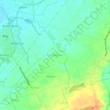
Name: Topografische Karte Concepcion, Höhe, Relief.
Ort: Concepcion, Laguna, Calabarzon, 4010, Philippines (14.20791 121.36270 14.24791 121.40270)
Durchschnittliche Höhe: 17 m
Minimale Höhe: 3 m
Maximale Höhe: 42 m
Andere topografische Karten
Klicken Sie auf eine Karte, um ihre Topografie, ihre Höhe und ihr Relief anzuzeigen.
Laguna de Bay
Laguna de Bay (Spanish for "Lagoon/Lake of Bay"; Tagalog: Lawa ng Bay, [baɪ]), also known as Laguna Lake, is the largest lake in the Philippines. It is located southeast of Metro Manila, between the provinces of Laguna to the south and Rizal to the north. A freshwater lake, it has a surface area of 911–949…
Durchschnittliche Höhe: 62 m
Kalayaan
Kalayaan is roughly rectangular in shape, with a hilly terrain on most of its eastern side, while relatively flat on its western side. Its highest elevations are from 400 to 418 metres. These are found in Sitio Santo Angel, Malaking Pulo, and Cabuhayan in Barangay San Juan, and Sitio Lamao in Barangay San…
Durchschnittliche Höhe: 159 m
Luisiana
Locals call the town Little Amigos Dísmo because of its high elevation and cool climate like the City of Baguio.
Durchschnittliche Höhe: 300 m
Majayjay
Majayjay is situated in the southernmost part of Laguna. It nestles at the foot of Mt. Banahaw, and due to its higher altitude at some 2,700+ ft above sea level, the town makes for a popular vacation destination during summer in the Philippines. It was once branded as the 'Summer Capital of the Philippines'…
Durchschnittliche Höhe: 488 m
Pangil
The municipality is strategically situated at the southern tip of Sierra Madre mountain range (six barangays) and along the eastern margin of Jalajala Peninsula and just west of the northwestern shore of the easternmost major embayment of Laguna de Bay (two barangays). Its narrow strip of territory traverses…
Durchschnittliche Höhe: 165 m
Siniloan
Buruwisan falls is located in Siniloan Laguna which is around eighty kilometers east of Manila. To get there we had to cross the long winding roads of Teresa and Bugarin to Mabitac. By public transport Take UV express vans bound to Tanay market in Starmall-Shaw terminal (P70). Then in Tanay market, ride a…
Durchschnittliche Höhe: 120 m
Mounts Banahaw–San Cristobal Protected Landscape
Philippines > Laguna > Nagcarlan
Durchschnittliche Höhe: 707 m
Balanac River Irrigation Dam
Philippines > Laguna > Magdalena > Ilayang Atingay
Durchschnittliche Höhe: 56 m
Bumbungan River
Philippines > Laguna > Pagsanjan > Uno
The waterfalls for which the Bumbungan river is famous is the Magdapio Falls, a section of the river in the town of Cavinti where the river drops about 300 feet (91 m). Because the original boat ride to reach the falls starts in Pagsanjan, it became known as the Pagsanjan Falls. This round trip boat ride…
Durchschnittliche Höhe: 85 m
UPLB CFNR Alumni Forest and Nature Park
Philippines > Laguna > Los Baños
Durchschnittliche Höhe: 148 m