Topografische Karten Lower Saxony
Klicken Sie auf eine Karte, um ihre Topografie, ihre Höhe und ihr Relief anzuzeigen.




Becken
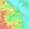
Germany > Lower Saxony > Landkreis Rotenburg (Wümme) > Steddorf > Boitzenbostel
Durchschnittliche Höhe: 30 m






Großenging
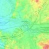
Germany > Lower Saxony > Cloppenburg district > Lindern (Oldenburg)
Durchschnittliche Höhe: 35 m


Rohden
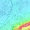
Germany > Lower Saxony > Landkreis Hameln-Pyrmont > Hessisch Oldendorf
Durchschnittliche Höhe: 149 m

Nettelrede
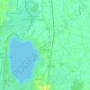
Germany > Lower Saxony > Landkreis Hameln-Pyrmont > Bad Münder am Deister
Durchschnittliche Höhe: 177 m











Braake
Germany > Lower Saxony > Landkreis Wesermarsch > Lemwerder > Altenesch
Durchschnittliche Höhe: 1 m


OS Hahnenklee-Bockswiese
Germany > Lower Saxony > Landkreis Goslar > Goslar
Durchschnittliche Höhe: 575 m

Nationalpark Harz
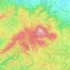
Germany > Lower Saxony > Landkreis Goslar
Several rivers have their sources in the national park, including the Bode, the Oder and the Ilse, a tributary of the Oker. The waters of the Oder, flowing southwards, are collected in the historic Oderteich reservoir, finished in 1722 to supply the mines in Sankt Andreasberg, and feed the Oder Dam on the…
Durchschnittliche Höhe: 533 m




Waldkater
Germany > Lower Saxony > Region Hannover > Wennigsen (Deister)
Durchschnittliche Höhe: 152 m
Torfhaus
Germany > Lower Saxony > Landkreis Goslar > Clausthal-Zellerfeld
Durchschnittliche Höhe: 748 m
Clausthal-Zellerfeld
Germany > Lower Saxony > Landkreis Goslar
Clausthal-Zellerfeld is a town in Lower Saxony, Germany. It is located in the southwestern part of the Harz mountains. Its population is approximately 15,000. The town hosts the Clausthal University of Technology. The health resort is located in the Upper Harz at an altitude between 390 and 821 m above sea…
Durchschnittliche Höhe: 466 m


Winzenburg
Germany > Lower Saxony > Landkreis Hildesheim > Freden (Leine)
Durchschnittliche Höhe: 204 m