

Topografische Karten Germany
Klicken Sie auf eine Karte, um ihre Topografie, ihre Höhe und ihr Relief anzuzeigen.

Berlin
Berlin straddles the banks of the River Spree, which flows into the River Havel (a tributary of the River Elbe) in the western borough of Spandau. Among the city's main topographical features are the many lakes in the western and southeastern boroughs formed by the Spree, Havel, and Dahme rivers (the largest…
Durchschnittliche Höhe: 47 m

Stuttgart
Germany > Baden-Württemberg > Stuttgart
Stuttgart covers an area of 207.35 km2 (80 sq mi) and sits at elevation ranging from 207 m (679 ft) above sea level by the Neckar river to 549 m (1,801 ft) on Bernhartshöhe hill – something rather unique in large German cities. The most prominent elevated locales in Stuttgart are the Birkenkopf (511 m…
Durchschnittliche Höhe: 353 m

St. Johanner Markt
Germany > Saarland > Regionalverband Saarbrücken > Saarbrücken
Durchschnittliche Höhe: 215 m

Medelon
Germany > North Rhine-Westphalia > Hochsauerlandkreis > Medebach
Durchschnittliche Höhe: 447 m

Neptun
Germany > Saxony > Sächsische Schweiz-Osterzgebirge > Bad Schandau
Durchschnittliche Höhe: 276 m

Krottelbach
Germany > Rhineland-Palatinate > Landkreis Kusel
The municipality lies in the Western Palatinate near the state boundary with the Saarland. Krottelbach lies on the upper reaches of its namesake brook, the Krottelbach, which rises in the woods west of the village. Several tributary brooks flow from side valleys, forming a radial pattern and emptying into the…
Durchschnittliche Höhe: 329 m

Hamburg
The neighborhoods of Neuenfelde, Cranz, Francop and Finkenwerder are part of the Altes Land (old land) region, the largest contiguous fruit-producing region in Central Europe. Neugraben-Fischbek has Hamburg's highest elevation, the Hasselbrack at 116.2 metres (381 ft) AMSL. Hamburg borders the states of…
Durchschnittliche Höhe: 56 m

Pilsach
Germany > Bavaria > Landkreis Neumarkt in der Oberpfalz > Pilsach
Durchschnittliche Höhe: 500 m




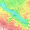

Hamburg
The neighborhoods of Neuenfelde, Cranz, Francop and Finkenwerder are part of the Altes Land (old land) region, the largest contiguous fruit-producing region in Central Europe. Neugraben-Fischbek has Hamburg's highest elevation, the Hasselbrack at 116.2 metres (381 ft) AMSL. Hamburg borders the states of…
Durchschnittliche Höhe: 23 m


Buchen (Odenwald)
Germany > Baden-Württemberg > Neckar-Odenwald-Kreis
Buchen is situated on the seam between the south-eastern Odenwald and the Bauland area, along the Upper Germanic-Rhaetian Limes. It lies geographically in the triangle formed by the cities of Mannheim, Würzburg and Heilbronn. The precincts of the municipality lie in the Natural Park of the Neckar Valley and…
Durchschnittliche Höhe: 389 m



Kuppenheim
Germany > Baden-Württemberg > Landkreis Rastatt
An old Oberndorf legend exists of a forest woman named Riedelwiebel. To young children, people would say: "Don't go to Riedel, else Riedelwiebel will get you!" Riedelwiebel was a witch in the Riedel Valley (forest between Oberndorf and Kuppenheim) who allegedly guarded a golden calf buried at the highest…
Durchschnittliche Höhe: 164 m


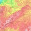
Swabian Jura
The highest elevations reach just over 1,000 metres (3,300 ft). They are all in the southwestern part of the Jura, in the region of the Großer Heuberg.
Durchschnittliche Höhe: 553 m



27330
Germany > Lower Saxony > Landkreis Diepholz > Asendorf > Kampsheide
Durchschnittliche Höhe: 50 m





Delitz am Berge
Germany > Saxony-Anhalt > Saalekreis > Goethestadt Bad Lauchstädt
Durchschnittliche Höhe: 109 m



Ehrsen-Breden
Germany > North Rhine-Westphalia > Kreis Lippe > Bad Salzuflen > Breden
Durchschnittliche Höhe: 112 m


Lahn-Dill-Kreis
The main rivers of the district are the Lahn and the Dill, which also gave it the name. It is mountain landscape with the Westerwald in the west, the Taunus in the south, the Lahn-Dill-Bergland in the east and the Rothaargebirge of the Sauerland in the north. The highest elevation with 671 m (2,201 ft) is near…
Durchschnittliche Höhe: 333 m





Ringschnait
Germany > Baden-Württemberg > Landkreis Biberach > Biberach an der Riß
Durchschnittliche Höhe: 623 m
Regglisweiler
Germany > Baden-Württemberg > Alb-Donau-Kreis > Dietenheim
Durchschnittliche Höhe: 527 m



Bad Berleburg
Germany > North Rhine-Westphalia > Kreis Siegen-Wittgenstein
Durchschnittliche Höhe: 545 m


Schönau am Königssee
Germany > Bavaria > Landkreis Berchtesgadener Land
Durchschnittliche Höhe: 1.498 m




Brakel
Germany > North Rhine-Westphalia > Kreis Höxter
Brakel's Hanseatic roots go back to its early history and stretch through the Middle Ages. From the first written reference to "villa brechal" in 836 (in connection with transferring Saint Vitus's bones from Saint Denis, France, to Corvey) through to the 12th century, when it was the seat of the Lords of…
Durchschnittliche Höhe: 232 m


Danger of ground subsidence!
Germany > Brandenburg > Dahme-Spreewald > Luckau > Fürstlich Drehna
Durchschnittliche Höhe: 78 m


Mutlangen
Germany > Baden-Württemberg > Ostalbkreis
Mutlangen is located between the Welzheim Forest and the Swabian Keuper-Lias Plains on an elevation above the Rems valley. The neighboring communes of Mutlangen are Durlangen in the north, the city of Schwäbisch Gmünd in the east and south as well as Alfdorf in the west. Mutlangen consists of the small town…
Durchschnittliche Höhe: 448 m

