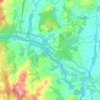
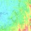
Topografische Karte Muimenta
Klicken Sie auf die Karte, um die Höhe anzuzeigen.
Über diese Karte

Name: Topografische Karte Muimenta, Höhe, Relief.
Ort: Muimenta, Cospeito, Terra Chá, Lugo, Galicia, 27256, Spain (43.23309 -7.45137 43.27309 -7.41137)
Durchschnittliche Höhe: 417 m
Minimale Höhe: 405 m
Maximale Höhe: 457 m
Andere topografische Karten
Klicken Sie auf eine Karte, um ihre Topografie, ihre Höhe und ihr Relief anzuzeigen.

Abadín
Abadín is situated in the north-east of Terra Chá. The municipality is crossed by the Serra do Xistral, the Cordal de Neda, and the rivers Labrada and Abadín. The mean elevation is of 500 m, and the highest point is Lombo Pequeno at 1015 m.
Durchschnittliche Höhe: 547 m
Castro de Rei
Castro de Rei is located in the comarca of the Terra Cha. This factor determines the most of their socioeconomic characteristics. Its average altitude is between 400 and 500 meters. In the east the terrain becomes more rugged due to its proximity to the eastern mountains. The elevation of the Montes dos…
Durchschnittliche Höhe: 505 m