
Topografische Karte Parker City
Interaktive Karte
Klicken Sie auf die Karte, um die Höhe anzuzeigen.
Über diese Karte
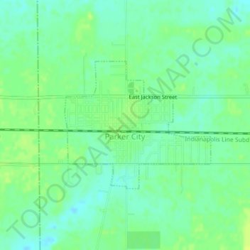
Name: Topografische Karte Parker City, Höhe, Relief.
Ort: Parker City, Randolph County, Indiana, 47368, United States (40.18327 -85.21266 40.19704 -85.19199)
Durchschnittliche Höhe: 312 m
Minimale Höhe: 304 m
Maximale Höhe: 319 m
According to the 2010 census, Parker City has a total area of 0.57 square miles (1.48 km2), all land. It is located at an elevation of 1025 feet.
Andere topografische Karten
Klicken Sie auf eine Karte, um ihre Topografie, ihre Höhe und ihr Relief anzuzeigen.
Union City
United States > Indiana > Randolph County
Union City, Randolph County, Indiana, United States
Durchschnittliche Höhe: 333 m
Windsor
United States > Indiana > Randolph County
Windsor, Randolph County, Indiana, 47368, United States
Durchschnittliche Höhe: 312 m
Farmland
United States > Indiana > Randolph County
Farmland, Randolph County, Indiana, United States
Durchschnittliche Höhe: 318 m
Lynn
United States > Indiana > Randolph County
Lynn, Randolph County, Indiana, United States
Durchschnittliche Höhe: 356 m
Modoc
United States > Indiana > Randolph County
Modoc, Randolph County, Indiana, United States
Durchschnittliche Höhe: 355 m
Winchester
United States > Indiana > Randolph County
Winchester, Randolph County, Indiana, 47494, United States
Durchschnittliche Höhe: 335 m