
Topografische Karte Bocana
Klicken Sie auf die Karte, um die Höhe anzuzeigen.
Über diese Karte
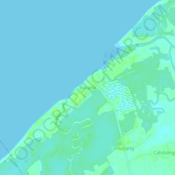
Name: Topografische Karte Bocana, Höhe, Relief.
Ort: Bocana, Negros Occidental, Western Visayas, 6109, Philippines (9.99111 122.69946 10.03111 122.73946)
Durchschnittliche Höhe: 2 m
Minimale Höhe: 0 m
Maximale Höhe: 11 m
Andere topografische Karten
Klicken Sie auf eine Karte, um ihre Topografie, ihre Höhe und ihr Relief anzuzeigen.
Cauayan
Philippines > Negros Occidental
The municipality of Cauayan has a rugged topography. Mt. Malipantao, considered the highest peak in the province, separates the municipality from the town of Candoni and the city of Sipalay. Portion of the ranges are the remaining thick forest that needs protection where the watershed is located. The remaining…
Durchschnittliche Höhe: 91 m