
Spenden
Topografische Karte Amuntai
Klicken Sie auf die Karte, um die Höhe anzuzeigen.
Spenden
Über diese Karte
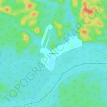
Name: Topografische Karte Amuntai, Höhe, Relief.
Ort: Amuntai, Montalvo (Andoas), Pastaza, Ecuador (-2.55978 -76.85949 -2.51978 -76.81949)
Durchschnittliche Höhe: 255 m
Minimale Höhe: 241 m
Maximale Höhe: 299 m
Spenden
Andere topografische Karten
Klicken Sie auf eine Karte, um ihre Topografie, ihre Höhe und ihr Relief anzuzeigen.
Puyo
Puyo (Spanish pronunciation: [ˈpuʝo]), also known as El Puyo, is the capital of Pastaza, a province in Ecuador. Puyo is located at an altitude of approximately 950 metres above sea level by the Puyo River, a tributary of the Pastaza River, which eventually leads into the Amazon River. True to its name,…
Durchschnittliche Höhe: 1.022 m
Spenden