
Topografische Karte Kejimkujik National Park and National Historic Site of Canada
Interaktive Karte
Klicken Sie auf die Karte, um die Höhe anzuzeigen.
Über diese Karte
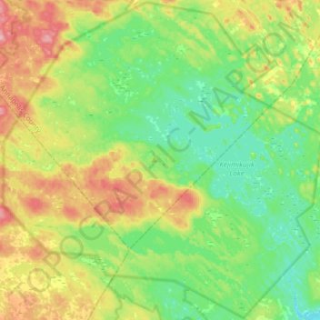
Name: Topografische Karte Kejimkujik National Park and National Historic Site of Canada, Höhe, Relief.
Durchschnittliche Höhe: 121 m
Minimale Höhe: 78 m
Maximale Höhe: 206 m
Andere topografische Karten
Klicken Sie auf eine Karte, um ihre Topografie, ihre Höhe und ihr Relief anzuzeigen.
Jakes Landing
Canada > Nova Scotia > Municipality of the County of Annapolis > Kejimkujik National Park of Canada
Jakes Landing, Kejimkujik National Park of Canada, Municipality of the County of Annapolis, Annapolis County, Nova Scotia, B0T 1N0, Canada
Durchschnittliche Höhe: 102 m