
Topografische Karte Jakes Landing
Interaktive Karte
Klicken Sie auf die Karte, um die Höhe anzuzeigen.
Über diese Karte
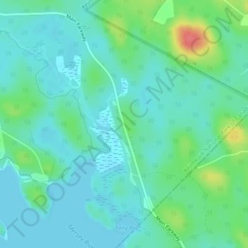
Name: Topografische Karte Jakes Landing, Höhe, Relief.
Durchschnittliche Höhe: 102 m
Minimale Höhe: 87 m
Maximale Höhe: 151 m
Andere topografische Karten
Klicken Sie auf eine Karte, um ihre Topografie, ihre Höhe und ihr Relief anzuzeigen.
Kejimkujik National Park and National Historic Site of Canada
Canada > Nova Scotia > Municipality of the County of Annapolis > Kejimkujik National Park of Canada
Kejimkujik National Park and National Historic Site of Canada, Kejimkujik National Park of Canada, Municipality of the County of Annapolis, Annapolis County, Nova Scotia, B0T 1N0, Canada
Durchschnittliche Höhe: 121 m