Geolokalisieren

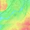
Topografische Karte Observatory Hill

Klicken Sie auf die Karte, um die Höhe anzuzeigen.

Über diese Karte

Name: Topografische Karte Observatory Hill, Höhe, Relief.

Ort: Observatory Hill, Bristol, City of Bristol, West of England, England, BS8 3LT, United Kingdom (51.45690 -2.62657 51.45700 -2.62647)

Durchschnittliche Höhe: 64 m

Minimale Höhe: -14 m

Maximale Höhe: 136 m

Andere topografische Karten

Klicken Sie auf eine Karte, um ihre Topografie, ihre Höhe und ihr Relief anzuzeigen.

Nightingale Valley

United Kingdom > England > City of Bristol > Bristol

Durchschnittliche Höhe: 38 m

Canford Park

United Kingdom > England > City of Bristol > Bristol

Durchschnittliche Höhe: 53 m

Bristol Port Railway

United Kingdom > England > City of Bristol > Bristol

Durchschnittliche Höhe: 68 m

Clifton Down

United Kingdom > England > City of Bristol > Bristol

Durchschnittliche Höhe: 73 m

St Andrew's Park

United Kingdom > England > City of Bristol > Bristol

Durchschnittliche Höhe: 47 m

Penpole Wood

United Kingdom > England > City of Bristol > Bristol

Durchschnittliche Höhe: 24 m

Rownham Plantation

United Kingdom > England > City of Bristol > Bristol

Durchschnittliche Höhe: 58 m

Whitchurch Park Ward

United Kingdom > England > City of Bristol > Bristol

Durchschnittliche Höhe: 91 m

Purdown

United Kingdom > England > City of Bristol > Bristol

Durchschnittliche Höhe: 47 m

Blaise Castle

United Kingdom > England > City of Bristol > Bristol

Durchschnittliche Höhe: 44 m

Stoke Park Estate

United Kingdom > England > City of Bristol > Bristol

Durchschnittliche Höhe: 57 m

Floating Harbour

United Kingdom > England > City of Bristol > Bristol

Durchschnittliche Höhe: 30 m

Netham Park

United Kingdom > England > City of Bristol > Bristol

Durchschnittliche Höhe: 28 m

Henleaze Lake

United Kingdom > England > City of Bristol > Bristol

Durchschnittliche Höhe: 66 m