

Vielen Dank für die Unterstützung dieser Website ❤️
Spenden
Spenden
Topografische Karte Natrona
Klicken Sie auf die Karte, um die Höhe anzuzeigen.
Vielen Dank für die Unterstützung dieser Website ❤️
Spenden
Spenden
Über diese Karte

Name: Topografische Karte Natrona, Höhe, Relief.
Ort: Natrona, Natrona County, Wyoming, United States (43.00956 -106.82953 43.04956 -106.78953)
Durchschnittliche Höhe: 1.719 m
Minimale Höhe: 1.695 m
Maximale Höhe: 1.756 m
Vielen Dank für die Unterstützung dieser Website ❤️
Spenden
Spenden
Andere topografische Karten
Klicken Sie auf eine Karte, um ihre Topografie, ihre Höhe und ihr Relief anzuzeigen.
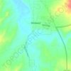
Midwest
United States > Wyoming > Natrona County
The town of Midwest, located in Natrona County, Wyoming, sits in a relatively flat, semi-arid landscape characterized by the rolling hills and gentle slopes typical of the Great Plains region. The area's topography is largely defined by expansive grasslands and isolated buttes. Midwest is positioned near…
Durchschnittliche Höhe: 1.482 m

Vielen Dank für die Unterstützung dieser Website ❤️
Spenden
Spenden
Vielen Dank für die Unterstützung dieser Website ❤️
Spenden
Spenden