
Vielen Dank für die Unterstützung dieser Website ❤️
Spenden
Spenden
Topografische Karte Alvarelhos
Klicken Sie auf die Karte, um die Höhe anzuzeigen.
Vielen Dank für die Unterstützung dieser Website ❤️
Spenden
Spenden
Über diese Karte
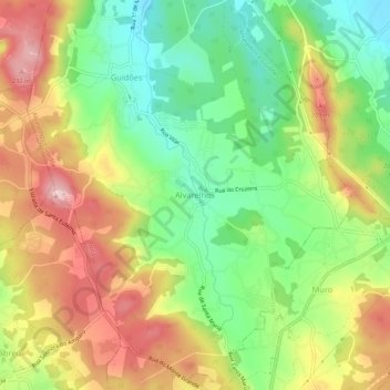
Name: Topografische Karte Alvarelhos, Höhe, Relief.
Ort: Alvarelhos, Trofa, Porto, 4485-266, Portugal (41.29079 -8.63154 41.33079 -8.59154)
Durchschnittliche Höhe: 124 m
Minimale Höhe: 28 m
Maximale Höhe: 236 m
Vielen Dank für die Unterstützung dieser Website ❤️
Spenden
Spenden
Andere topografische Karten
Klicken Sie auf eine Karte, um ihre Topografie, ihre Höhe und ihr Relief anzuzeigen.