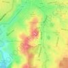
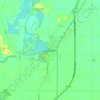
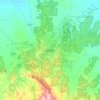
Topografische Karte Albert Park
Klicken Sie auf die Karte, um die Höhe anzuzeigen.
Albert Park
Heritage Victoria notes that Albert Park's St Vincent Gardens "is historically important as the premier 'square' development in Victoria based on similar models in London. It is significant as the largest development of its type in Victoria and for its unusual development as gardens rather than the more usual small park" and "was first laid out in 1854 or 55, probably by Andrew Clarke, the Surveyor-General of Victoria. The current layout is the work of Clement Hodgkinson, the noted surveyor, engineer and topographer, who adapted the design in 1857 to allow for its intersection by the St Kilda railway line. The precinct, which in its original configuration extended from Park Street in the north to Bridport Street in the south and from Howe Crescent in the east to Nelson Road and Cardigan Street in the west, was designed to emulate similar 'square' developments in London, although on a grander scale. The main streets were named after British naval heroes. The development of the special character of St Vincent Place has been characterised, since the first land sales in the 1860s, by a variety of housing stock, which has included quality row and detached houses and by the gardens which, although they have been continuously developed, remain faithful to the initial landscape concept."
Über diese Karte

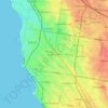
Name: Topografische Karte Albert Park, Höhe, Relief.
Ort: Albert Park, Victoria, 3206, Australia (-37.85365 144.94273 -37.83709 144.97894)
Durchschnittliche Höhe: 6 m
Minimale Höhe: 0 m
Maximale Höhe: 36 m
Andere topografische Karten
Klicken Sie auf eine Karte, um ihre Topografie, ihre Höhe und ihr Relief anzuzeigen.
Ballarat
Ballarat has a moderate oceanic climate (Köppen climate classification Cfb) with four distinct seasons. Its elevation, ranging between 400 and 630 metres (1,310 and 2,070 feet) above sea level, causes its mean monthly temperatures to tend to be on average 3 to 5 °C (5 to 9 °F) below those of Melbourne,…
Durchschnittliche Höhe: 470 m

Melbourne
Melbourne is also prone to isolated convective showers forming when a cold pool crosses the state, especially if there is considerable daytime heating. These showers are often heavy and can include hail, squalls, and significant drops in temperature, but they often pass through very quickly with a rapid…
Durchschnittliche Höhe: 49 m






















Mount Bogong
The Big River separates the massif of the mountain from the Bogong High Plains to the south. From the nearby town of Mount Beauty to its summit, Mount Bogong rises more than 1,600 metres (5,200 ft), thus making it one of the highest peaks in Australia not only in terms of its elevation above sea level, but…
Durchschnittliche Höhe: 1.719 m









Buffalo Plateau
The summit of the highest peak of the plateau, known as The Horn, has an elevation of 1,723 metres (5,653 ft) AHD.
Durchschnittliche Höhe: 1.502 m