
Topografische Karte Wermsdorf
Interaktive Karte
Klicken Sie auf die Karte, um die Höhe anzuzeigen.
Wermsdorf
There are numerous cycling routes of low elevation and trail-ways suitable for walking scattered throughout the nearby Wermsdorf Woods. The nearby lakes are available for bathing, boating and fresh water fishing. Wermsdorf also has a number of hostelries for the enjoyment of traditional German food and drink.
Über diese Karte
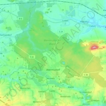
Name: Topografische Karte Wermsdorf, Höhe, Relief.
Ort: Wermsdorf, Nordsachsen, Saxony, 04779, Germany (51.24084 12.86866 51.35502 13.04971)
Durchschnittliche Höhe: 176 m
Minimale Höhe: 131 m
Maximale Höhe: 313 m