Geolokalisieren
👉 Easily get elevation data in JSON, GeoTIFF and KML formats using Elevation API
Vielen Dank für die Unterstützung dieser Website ❤️
Spenden

Topografische Karte Pulikkanny

Klicken Sie auf die Karte, um die Höhe anzuzeigen.

👉 Easily get elevation data in JSON, GeoTIFF and KML formats using Elevation API
Vielen Dank für die Unterstützung dieser Website ❤️
Spenden

Über diese Karte

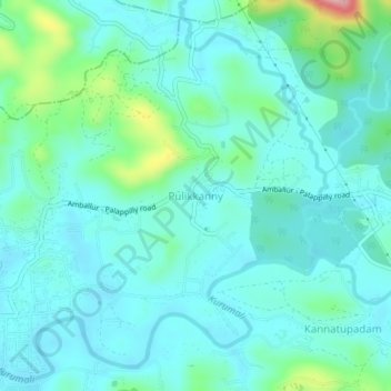
Name: Topografische Karte Pulikkanny, Höhe, Relief.

Ort: Pulikkanny, Chalakkudy, Thrissur, Kerala, 680303, India (10.41613 76.34357 10.45613 76.38357)

Durchschnittliche Höhe: 36 m

Minimale Höhe: 6 m

Maximale Höhe: 169 m

👉 Easily get elevation data in JSON, GeoTIFF and KML formats using Elevation API
Vielen Dank für die Unterstützung dieser Website ❤️
Spenden

Andere topografische Karten

Klicken Sie auf eine Karte, um ihre Topografie, ihre Höhe und ihr Relief anzuzeigen.

Kuzhur

India > Kerala > Chalakkudy > Valiyaparambu

Durchschnittliche Höhe: 7 m

Kakkulissery

India > Kerala > Chalakkudy > Valiyaparambu

Durchschnittliche Höhe: 10 m

Thiruthiparambu East

India > Kerala > Chalakkudy > Chalakudy

Durchschnittliche Höhe: 10 m

Athirappilly

India > Kerala > Chalakkudy

Durchschnittliche Höhe: 406 m

Vielen Dank für die Unterstützung dieser Website ❤️
Spenden

Kadukutty

India > Kerala > Chalakkudy > Sampaloor

Durchschnittliche Höhe: 8 m

Nandipulam

India > Kerala > Chalakkudy

Durchschnittliche Höhe: 16 m

St James Hospital

India > Kerala > Chalakkudy > Chalakudy

Durchschnittliche Höhe: 14 m

Lower Sholayar Dam

India > Kerala > Chalakkudy

Durchschnittliche Höhe: 773 m

Vielen Dank für die Unterstützung dieser Website ❤️
Spenden

Mattathur

India > Kerala > Chalakkudy > Kodaly

Durchschnittliche Höhe: 199 m

St James Hospital

India > Kerala > Chalakkudy > Chalakudy

Durchschnittliche Höhe: 14 m