
Vielen Dank für die Unterstützung dieser Website ❤️
Spenden
Spenden
Topografische Karte Paraiso
Klicken Sie auf die Karte, um die Höhe anzuzeigen.
Vielen Dank für die Unterstützung dieser Website ❤️
Spenden
Spenden
Über diese Karte
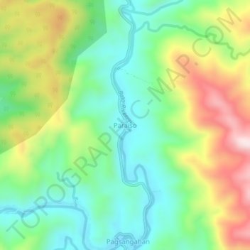
Name: Topografische Karte Paraiso, Höhe, Relief.
Ort: Paraiso, Catanduanes, Bicol Region, Philippines (13.72342 124.25101 13.76342 124.29101)
Durchschnittliche Höhe: 200 m
Minimale Höhe: 29 m
Maximale Höhe: 496 m
Vielen Dank für die Unterstützung dieser Website ❤️
Spenden
Spenden
Andere topografische Karten
Klicken Sie auf eine Karte, um ihre Topografie, ihre Höhe und ihr Relief anzuzeigen.