
Topografische Karte Vila do Carvalho
Interaktive Karte
Klicken Sie auf die Karte, um die Höhe anzuzeigen.
Über diese Karte
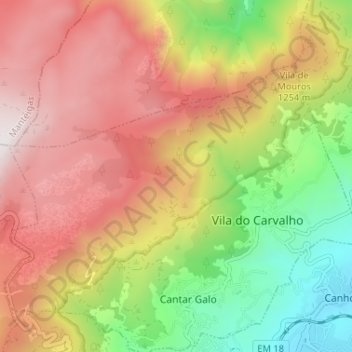
Name: Topografische Karte Vila do Carvalho, Höhe, Relief.
Ort: Vila do Carvalho, Covilhã, Castelo Branco, Portugal (40.29812 -7.53832 40.32924 -7.47356)
Durchschnittliche Höhe: 1.073 m
Minimale Höhe: 459 m
Maximale Höhe: 1.649 m
Andere topografische Karten
Klicken Sie auf eine Karte, um ihre Topografie, ihre Höhe und ihr Relief anzuzeigen.
Tortosendo
Portugal > Castelo Branco > Covilhã
Tortosendo, Covilhã, Castelo Branco, Portugal
Durchschnittliche Höhe: 564 m
Cantar-Galo
Portugal > Castelo Branco > Covilhã
Cantar-Galo, Cantar-Galo e Vila do Carvalho, Covilhã, Castelo Branco, 6200-405, Portugal
Durchschnittliche Höhe: 1.093 m
Casegas
Portugal > Castelo Branco > Covilhã
Casegas, Covilhã, Castelo Branco, 6230-661, Portugal
Durchschnittliche Höhe: 504 m
Unhais da Serra
Portugal > Castelo Branco > Covilhã
Unhais da Serra, Covilhã, Castelo Branco, Portugal
Durchschnittliche Höhe: 1.085 m