
Topografische Karte The Borough District of Drogheda
Interaktive Karte
Klicken Sie auf die Karte, um die Höhe anzuzeigen.
Über diese Karte
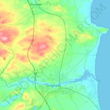
Name: Topografische Karte The Borough District of Drogheda, Höhe, Relief.
Durchschnittliche Höhe: 50 m
Minimale Höhe: -1 m
Maximale Höhe: 209 m
Andere topografische Karten
Klicken Sie auf eine Karte, um ihre Topografie, ihre Höhe und ihr Relief anzuzeigen.
Dundalk
Irlande > County Louth > Dundalk
Dundalk, The Municipal District of Dundalk, County Louth, Leinster, A91 RC44, Irlande
Durchschnittliche Höhe: 16 m