
Topografische Karte Pura
Klicken Sie auf die Karte, um die Höhe anzuzeigen.
Pura
Pura, just like any other town in the province of the Tarlac has two (2) pronounced seasons. The wet season that starts from May up to lasts up to September and dry from the month of October to April. This type of climate is typically hot, humid, and tropical and is generally affected by the neighboring topography and prevalent wind direction that varies within the year. Tropical monsoon is carried into the area from the southeast in the month of May to September thereby causing heavy rainfall in the area. Most of the rainfalls are associated with typhoons.
Über diese Karte
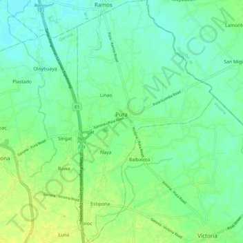
Name: Topografische Karte Pura, Höhe, Relief.
Ort: Pura, Tarlac, Central Luzon, 2312, Philippines (15.57430 120.62841 15.66762 120.68400)
Durchschnittliche Höhe: 23 m
Minimale Höhe: 16 m
Maximale Höhe: 32 m
Andere topografische Karten
Klicken Sie auf eine Karte, um ihre Topografie, ihre Höhe und ihr Relief anzuzeigen.