
Topografische Karte Middle Fork of Wildcat Creek
Interaktive Karte
Klicken Sie auf die Karte, um die Höhe anzuzeigen.
Über diese Karte
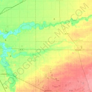
Name: Topografische Karte Middle Fork of Wildcat Creek, Höhe, Relief.
Durchschnittliche Höhe: 215 m
Minimale Höhe: 174 m
Maximale Höhe: 256 m
Andere topografische Karten
Klicken Sie auf eine Karte, um ihre Topografie, ihre Höhe und ihr Relief anzuzeigen.
Fort Branch
USA > Indiana > Fort Branch
Fort Branch, Gibson County, Indiana, 47648, USA
Durchschnittliche Höhe: 136 m
Dearborn County
Sparta Township, Dearborn County, Indiana, 47032, USA
Durchschnittliche Höhe: 267 m
Saint Henry
USA > Indiana > Saint Henry
Saint Henry, Dubois County, Indiana, USA
Durchschnittliche Höhe: 160 m
Lawrenceburg
USA > Indiana > Lawrenceburg
Lawrenceburg, Lawrenceburg Township, Dearborn County, Indiana, USA
Durchschnittliche Höhe: 168 m
Holmesville
USA > Indiana > Holmesville
Holmesville, LaPorte County, Indiana, 46391, USA
Durchschnittliche Höhe: 240 m