
Topografische Karte Great Basin
Interaktive Karte
Klicken Sie auf die Karte, um die Höhe anzuzeigen.
Über diese Karte
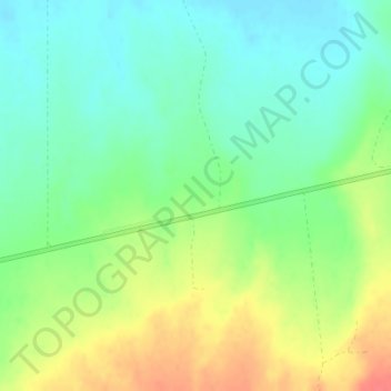
Name: Topografische Karte Great Basin, Höhe, Relief.
Ort: Great Basin, Eureka County, Nevada, United States (39.49995 -116.50005 39.50005 -116.49995)
Durchschnittliche Höhe: 1.918 m
Minimale Höhe: 1.896 m
Maximale Höhe: 1.952 m
The Great Basin is the largest area of contiguous endorheic watersheds, those with no outlets, in North America. It spans nearly all of Nevada, much of Utah, and portions of California, Idaho, Oregon, Wyoming, and Baja California. It is noted for both its arid climate and the basin and range topography that varies from the North American low point at Badwater Basin in Death Valley to the highest point of the contiguous United States, less than 100 miles (160 km) away at the summit of Mount Whitney. The region spans several physiographic divisions, biomes, ecoregions, and deserts.
Andere topografische Karten
Klicken Sie auf eine Karte, um ihre Topografie, ihre Höhe und ihr Relief anzuzeigen.
English Mountain
United States > Nevada > Eureka County
English Mountain, Eureka County, Nevada, United States
Durchschnittliche Höhe: 2.046 m
Aiken Spring
United States > Nevada > Eureka County
Aiken Spring, Diamond Mine, Eureka County, Nevada, United States
Durchschnittliche Höhe: 1.936 m