
Topografische Karte Baralacha Pass
Interaktive Karte
Klicken Sie auf die Karte, um die Höhe anzuzeigen.
Baralacha Pass
"The Bara Lacha is the boundary between two separate regions distinguished by their physical characteristics. That which we have already passed through may be called the true Himalayan region. Here the gigantic ranges are covered with perpetual snow, furrowed by glaciers, and they arise from amid dense forests which clothe their flanks up to a certain elevation. They are separated by deep gorges, whose sides are precipices, and though which large rivers flow. In fact the scenery is Alpine.
Über diese Karte
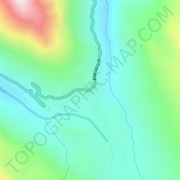
Name: Topografische Karte Baralacha Pass, Höhe, Relief.
Durchschnittliche Höhe: 4.983 m
Minimale Höhe: 4.770 m
Maximale Höhe: 5.595 m
Andere topografische Karten
Klicken Sie auf eine Karte, um ihre Topografie, ihre Höhe und ihr Relief anzuzeigen.