Topografische Karte Panhala
Interaktive Karte
Klicken Sie auf die Karte, um die Höhe anzuzeigen.
Über diese Karte
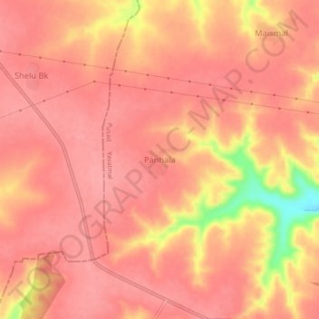
Name: Topografische Karte Panhala, Höhe, Relief.
Ort: Panhala, Pusad, Yavatmal, Maharashtra, India (19.96646 77.32413 20.00646 77.36413)
Durchschnittliche Höhe: 541 m
Minimale Höhe: 461 m
Maximale Höhe: 561 m
Andere topografische Karten
Klicken Sie auf eine Karte, um ihre Topografie, ihre Höhe und ihr Relief anzuzeigen.
Parwa
India > Maharashtra > Pusad
Parwa, Pusad, Yavatmal District, Maharashtra, India
Durchschnittliche Höhe: 424 m
Harshi
India > Maharashtra > Pusad
Harshi, Pusad, Yavatmal District, Maharashtra, India
Durchschnittliche Höhe: 373 m
Nagwadi
India > Maharashtra > Pusad
Nagwadi, Pusad, Yavatmal District, Maharashtra, India
Durchschnittliche Höhe: 427 m
Dahiwad
India > Maharashtra > Pusad
Dahiwad, Pusad, Yavatmal District, Maharashtra, India
Durchschnittliche Höhe: 329 m
Asoli
India > Maharashtra > Pusad
Asoli, Pusad, Yavatmal District, Maharashtra, India
Durchschnittliche Höhe: 336 m
Shilona
India > Maharashtra > Pusad
Shilona, Pusad, Yavatmal District, Maharashtra, India
Durchschnittliche Höhe: 374 m
Bibi
India > Maharashtra > Pusad
Bibi, Pusad, Yavatmal District, Maharashtra, India
Durchschnittliche Höhe: 417 m
Kharshi
India > Maharashtra > Pusad
Kharshi, Pusad, Yavatmal, Maharashtra, India
Durchschnittliche Höhe: 405 m