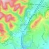
Topografische Karte Long Mynd
Klicken Sie auf die Karte, um die Höhe anzuzeigen.
Long Mynd
Long Mynd comprises a multitude of valleys, and the highest concentration lies along the eastern edge, near Church Stretton. Topographically, many of the larger valleys lie adjacent to each other and are aligned northwest to southeast. The main valleys include.
Über diese Karte

Name: Topografische Karte Long Mynd, Höhe, Relief.
Durchschnittliche Höhe: 292 m
Minimale Höhe: 141 m
Maximale Höhe: 513 m
Andere topografische Karten
Klicken Sie auf eine Karte, um ihre Topografie, ihre Höhe und ihr Relief anzuzeigen.
Minton
United Kingdom > England > Shropshire > Church Stretton > Little Stretton
Durchschnittliche Höhe: 272 m