
Vielen Dank für die Unterstützung dieser Website ❤️
Spenden
Spenden
Topografische Karte Pointe au Baril
Klicken Sie auf die Karte, um die Höhe anzuzeigen.
Vielen Dank für die Unterstützung dieser Website ❤️
Spenden
Spenden
Über diese Karte
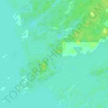
Name: Topografische Karte Pointe au Baril, Höhe, Relief.
Durchschnittliche Höhe: 177 m
Minimale Höhe: 172 m
Maximale Höhe: 186 m
Vielen Dank für die Unterstützung dieser Website ❤️
Spenden
Spenden
Andere topografische Karten
Klicken Sie auf eine Karte, um ihre Topografie, ihre Höhe und ihr Relief anzuzeigen.
Conger Lake
Canada > Ontario > Parry Sound District > The Archipelago Township
Durchschnittliche Höhe: 200 m
Skye Island
Canada > Ontario > Parry Sound District > The Archipelago Township
Durchschnittliche Höhe: 191 m