
Topografische Karte Neyveli
Klicken Sie auf die Karte, um die Höhe anzuzeigen.
Neyveli
Neyveli is located at 11°36′N 79°29′E / 11.60°N 79.48°E / 11.60; 79.48. It has an average elevation of 87 metres (285 ft). It is located along with the Chennai-Thanjavur National Highway. Neyveli was a planned township and is sub-divided into 'blocks'. There are 32 blocks with each block measuring 1 kilometre (0.62 mi) by 0.7 kilometres (0.43 mi) separated by double-lane roads. Each block has streets which are uniquely named. The township houses nearly 15,000 houses and apartments.
Über diese Karte
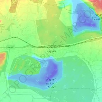
Name: Topografische Karte Neyveli, Höhe, Relief.
Ort: Neyveli, Virudhachalam, Cuddalore, Tamil Nadu, 607803, India (11.49599 79.44244 11.57599 79.52244)
Durchschnittliche Höhe: 23 m
Minimale Höhe: -65 m
Maximale Höhe: 96 m