
Topografische Karte Lake St Lucia
Interaktive Karte
Klicken Sie auf die Karte, um die Höhe anzuzeigen.
Über diese Karte
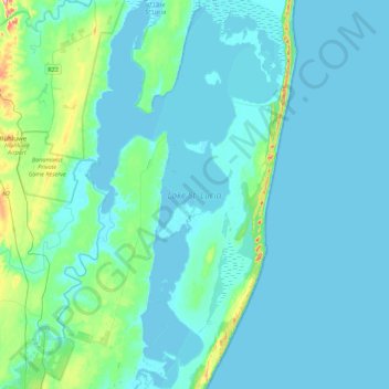
Name: Topografische Karte Lake St Lucia, Höhe, Relief.
Durchschnittliche Höhe: 20 m
Minimale Höhe: -5 m
Maximale Höhe: 189 m
Andere topografische Karten
Klicken Sie auf eine Karte, um ihre Topografie, ihre Höhe und ihr Relief anzuzeigen.
Hluhluwe
RSA > KwaZulu-Natal > The Big Five False Bay Local Municipality
Hluhluwe, The Big Five False Bay Local Municipality, Umkhanyakude District Municipality, KwaZulu-Natal, 3936, RSA
Durchschnittliche Höhe: 96 m
Makasa Nature Reserve
RSA > KwaZulu-Natal > The Big Five False Bay Local Municipality
Makasa Nature Reserve, D2039, Big Five False Bay Ward 1, The Big Five False Bay Local Municipality, Umkhanyakude District Municipality, KwaZulu-Natal, RSA
Durchschnittliche Höhe: 42 m