
Topografische Karte Murrells Inlet
Interaktive Karte
Klicken Sie auf die Karte, um die Höhe anzuzeigen.
Über diese Karte
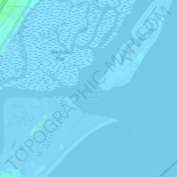
Name: Topografische Karte Murrells Inlet, Höhe, Relief.
Durchschnittliche Höhe: -1 m
Minimale Höhe: -4 m
Maximale Höhe: 5 m
Andere topografische Karten
Klicken Sie auf eine Karte, um ihre Topografie, ihre Höhe und ihr Relief anzuzeigen.
Georgetown County
Georgetown County, South Carolina, USA
Durchschnittliche Höhe: 6 m
Simmonsville
USA > South Carolina > Simmonsville
Simmonsville, Georgetown County, South Carolina, USA
Durchschnittliche Höhe: 5 m
Cape Romain National Wildlife Refuge
USA > South Carolina > Awendaw
Cape Romain National Wildlife Refuge, Awendaw, Charleston County, South Carolina, USA
Durchschnittliche Höhe: 3 m
Grenadier
USA > South Carolina > Grenadier
Grenadier, Lexington County, South Carolina, 29210, USA
Durchschnittliche Höhe: 74 m
Tenmile
USA > South Carolina > Tenmile
Tenmile, Charleston County, South Carolina, 29416, USA
Durchschnittliche Höhe: 9 m
Newberry County
Newberry County, South Carolina, USA
Durchschnittliche Höhe: 136 m
Charleston County
Charleston County, South Carolina, USA
Durchschnittliche Höhe: 5 m