
Topografische Karte Big Diomede
Interaktive Karte
Klicken Sie auf die Karte, um die Höhe anzuzeigen.
Big Diomede
Big Diomede Island is located about 45 km (28 mi) southeast of Cape Dezhnev on the Chukchi Peninsula and is Russia's easternmost point. The coordinates are 65°46′52″N 169°03′25″W / 65.78111°N 169.05694°W / 65.78111; -169.05694Coordinates: 65°46′52″N 169°03′25″W / 65.78111°N 169.05694°W / 65.78111; -169.05694. The rocky tuya-type island has an area of about 29 km2 (11 sq mi) The International Date Line is about 1.3 km (0.81 mi) east of the island. The highest point of the island is at 65°46'24.64" N, 169°04'06.61" W where the elevation reaches 1,566 feet (477 m).
Über diese Karte
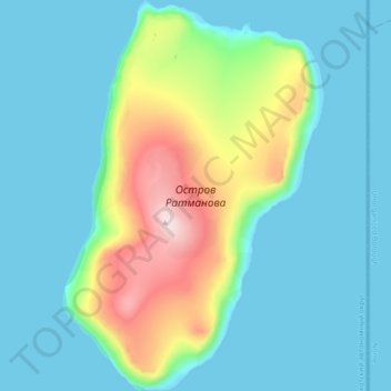
Name: Topografische Karte Big Diomede, Höhe, Relief.
Durchschnittliche Höhe: 101 m
Minimale Höhe: -1 m
Maximale Höhe: 501 m