
Topografische Karte Duanesburg
Interaktive Karte
Klicken Sie auf die Karte, um die Höhe anzuzeigen.
Duanesburg
The town consists of mostly wooded hills up to an elevation of approximately 1,400 feet (430 m) above sea level. Most of the town was cleared farmland until the late 20th century. After this point forests grew to cover 60% of the total land area with a canopy higher than 40 feet (12 m). The forest is primary composed of poplar, hemlock, oak, maple, white pine, and balsam fir. The maximum tree heights in Duanesburg are approximately 80 feet (24 m) high.
Über diese Karte
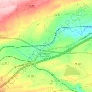
Name: Topografische Karte Duanesburg, Höhe, Relief.
Durchschnittliche Höhe: 267 m
Minimale Höhe: 154 m
Maximale Höhe: 410 m