
Topografische Karte Mount Sungay
Interaktive Karte
Klicken Sie auf die Karte, um die Höhe anzuzeigen.
Mount Sungay
Mount Sungay is the eastern end of the Tagaytay Range, or more commonly known as the Tagaytay Ridge, a 32-kilometre (20 mi) ridge located at the southern part of the province with elevations averaging about 600 m (2,000 ft) above sea level. The ridge stretches west-southwest from Mount Sungay to Mount Batulao in Batangas province.
Über diese Karte
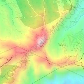
Name: Topografische Karte Mount Sungay, Höhe, Relief.
Durchschnittliche Höhe: 501 m
Minimale Höhe: 264 m
Maximale Höhe: 728 m
Andere topografische Karten
Klicken Sie auf eine Karte, um ihre Topografie, ihre Höhe und ihr Relief anzuzeigen.