
Topografische Karte Shawell
Klicken Sie auf die Karte, um die Höhe anzuzeigen.
Über diese Karte
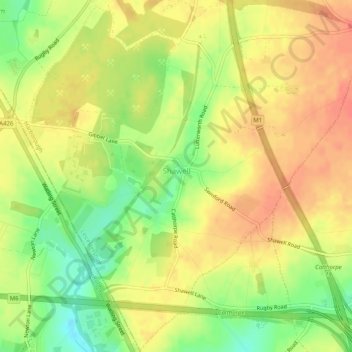
Name: Topografische Karte Shawell, Höhe, Relief.
Ort: Shawell, Leicestershire, England, United Kingdom (52.40187 -1.22362 52.43262 -1.17308)
Durchschnittliche Höhe: 127 m
Minimale Höhe: 98 m
Maximale Höhe: 145 m
Andere topografische Karten
Klicken Sie auf eine Karte, um ihre Topografie, ihre Höhe und ihr Relief anzuzeigen.
Swithland
United Kingdom > England > Leicestershire > Charnwood > Swithland
Durchschnittliche Höhe: 74 m
Cossington
United Kingdom > England > Leicestershire > Charnwood > Syston
Durchschnittliche Höhe: 61 m
Houghton on the Hill
United Kingdom > England > Leicestershire > Harborough
Durchschnittliche Höhe: 142 m
Willoughby Waterleys
United Kingdom > England > Leicestershire > Harborough
Durchschnittliche Höhe: 106 m
Coalville
United Kingdom > England > Leicestershire > North West Leicestershire
Durchschnittliche Höhe: 149 m
Market Harborough
United Kingdom > England > Leicestershire > Harborough
Durchschnittliche Höhe: 106 m
Hinckley
United Kingdom > England > Leicestershire > Hinckley and Bosworth
Durchschnittliche Höhe: 105 m
Lount
United Kingdom > England > Leicestershire > North West Leicestershire
Durchschnittliche Höhe: 118 m
Kibworth Harcourt
United Kingdom > England > Leicestershire > Harborough
Durchschnittliche Höhe: 117 m
Isley Walton
United Kingdom > England > Leicestershire > North West Leicestershire
Durchschnittliche Höhe: 76 m
Copt Oak
United Kingdom > England > Leicestershire > Hinckley and Bosworth
Durchschnittliche Höhe: 199 m
Markfield
United Kingdom > England > Leicestershire > Hinckley and Bosworth > Markfield
Durchschnittliche Höhe: 174 m
Castle Donington
United Kingdom > England > Leicestershire > North West Leicestershire > Hemington
Durchschnittliche Höhe: 56 m
Witherley
United Kingdom > England > Leicestershire > Hinckley and Bosworth
Durchschnittliche Höhe: 87 m
Kibworth Beauchamp
United Kingdom > England > Leicestershire > Harborough
Durchschnittliche Höhe: 113 m
Bottesford
United Kingdom > England > Leicestershire > Melton
Bottesford's many listed buildings include the grade I listed 13th-century Church of St Mary the Virgin. There are two scheduled monuments within the village – Fleming's Bridge and the stone cross in the Market Place. The stocks and whipping post are Grade II listed. One of the Grade II listed buildings,…
Durchschnittliche Höhe: 39 m
Ratcliffe Culey
United Kingdom > England > Leicestershire > Hinckley and Bosworth
Durchschnittliche Höhe: 77 m
South Croxton
United Kingdom > England > Leicestershire > Charnwood > South Croxton
The highest point is the church, at 120 m above mean sea level. The lowest altitude is 85 m by the Queniborough Brook.
Durchschnittliche Höhe: 108 m
Moira
United Kingdom > England > Leicestershire > North West Leicestershire
Durchschnittliche Höhe: 103 m
Thringstone
United Kingdom > England > Leicestershire > North West Leicestershire
Durchschnittliche Höhe: 126 m
Groby
United Kingdom > England > Leicestershire > Hinckley and Bosworth > Groby
Durchschnittliche Höhe: 107 m
Swannington
United Kingdom > England > Leicestershire > North West Leicestershire > Coalville
Durchschnittliche Höhe: 132 m
Stoughton
United Kingdom > England > Leicestershire > Harborough > Stoughton
Durchschnittliche Höhe: 122 m
Ashby-de-la-Zouch
United Kingdom > England > Leicestershire > North West Leicestershire
Durchschnittliche Höhe: 132 m
Queniborough
United Kingdom > England > Leicestershire > Charnwood > Queniborough
Durchschnittliche Höhe: 75 m
Illston on the Hill
United Kingdom > England > Leicestershire > Harborough
Durchschnittliche Höhe: 158 m
Gilmorton
United Kingdom > England > Leicestershire > Harborough > Gilmorton
Durchschnittliche Höhe: 136 m
Great Glen
United Kingdom > England > Leicestershire > Harborough > Great Glen
Durchschnittliche Höhe: 115 m
Buckminster
United Kingdom > England > Leicestershire > Melton > Buckminster
Durchschnittliche Höhe: 135 m
Stretton Baskerville
United Kingdom > England > Leicestershire > Hinckley and Bosworth
Durchschnittliche Höhe: 111 m
Stapleton
United Kingdom > England > Leicestershire > Hinckley and Bosworth
Durchschnittliche Höhe: 111 m
Leicester Forest East
United Kingdom > England > Leicestershire > Leicester Forest East
Durchschnittliche Höhe: 96 m
Breedon on the Hill
United Kingdom > England > Leicestershire > North West Leicestershire
Durchschnittliche Höhe: 84 m
Slawston
United Kingdom > England > Leicestershire > Harborough > Slawston
Durchschnittliche Höhe: 94 m
Ashby Parva
United Kingdom > England > Leicestershire > Harborough District
Durchschnittliche Höhe: 123 m
Beeby
United Kingdom > England > Leicestershire > Charnwood
The physical and historical development of the hamlet has been strongly influenced by the local topography and its relative isolation. Beeby is situated within an established agricultural landscape largely in pastoral use. Until 1904 the east-west route was the only route through the hamlet, which was referred…
Durchschnittliche Höhe: 101 m
Leicestershire
United Kingdom > England > Leicestershire
A large part of the north-west of the county, around Coalville, forms part of the new National Forest area extending into Derbyshire and Staffordshire. The highest point of the county is Bardon Hill at 278 m (912 ft), which is also a Marilyn; with other hilly/upland areas of c. 150–200 metres (490–660 ft)…
Durchschnittliche Höhe: 98 m
Hallaton
United Kingdom > England > Leicestershire > Harborough > Hallaton
Durchschnittliche Höhe: 125 m
Desford
United Kingdom > England > Leicestershire > Hinckley and Bosworth > Botcheston
Durchschnittliche Höhe: 115 m
Measham
United Kingdom > England > Leicestershire > North West Leicestershire
Durchschnittliche Höhe: 96 m
Newbold Verdon
United Kingdom > England > Leicestershire > Hinckley and Bosworth
Durchschnittliche Höhe: 129 m
Ibstock
United Kingdom > England > Leicestershire > North West Leicestershire
Durchschnittliche Höhe: 134 m
Market Bosworth
United Kingdom > England > Leicestershire > Hinckley and Bosworth
Durchschnittliche Höhe: 103 m
Shawell
United Kingdom > England > Leicestershire > Harborough > Shawell
Durchschnittliche Höhe: 125 m
Barrow upon Soar
United Kingdom > England > Leicestershire > Charnwood > Barrow upon Soar
Durchschnittliche Höhe: 62 m
Whitwick
United Kingdom > England > Leicestershire > North West Leicestershire
Durchschnittliche Höhe: 152 m
Appleby Magna
United Kingdom > England > Leicestershire > North West Leicestershire
Durchschnittliche Höhe: 95 m
Burbage
United Kingdom > England > Leicestershire > Hinckley and Bosworth > Stretton Baskerville
Durchschnittliche Höhe: 110 m
Shepshed
United Kingdom > England > Leicestershire > Charnwood > Shepshed
Durchschnittliche Höhe: 111 m
Barwell
United Kingdom > England > Leicestershire > Hinckley and Bosworth
Durchschnittliche Höhe: 110 m
Glooston
United Kingdom > England > Leicestershire > Harborough > Glooston
Durchschnittliche Höhe: 117 m
Eye Kettleby
United Kingdom > England > Leicestershire > Borough of Melton > Melton Mowbray
Durchschnittliche Höhe: 95 m