
Topografische Karte Anchor
Interaktive Karte
Klicken Sie auf die Karte, um die Höhe anzuzeigen.
Über diese Karte
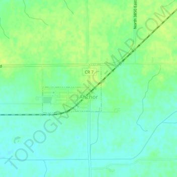
Name: Topografische Karte Anchor, Höhe, Relief.
Ort: Anchor, McLean County, Illinois, United States (40.56568 -88.54491 40.57305 -88.53308)
Durchschnittliche Höhe: 235 m
Minimale Höhe: 227 m
Maximale Höhe: 244 m
Andere topografische Karten
Klicken Sie auf eine Karte, um ihre Topografie, ihre Höhe und ihr Relief anzuzeigen.
Bloomington
United States > Illinois > McLean County
Bloomington, McLean County, Illinois, United States
Durchschnittliche Höhe: 246 m
Danvers
United States > Illinois > McLean County
Danvers, McLean County, Illinois, United States
Durchschnittliche Höhe: 245 m
Hudson
United States > Illinois > McLean County
Hudson, McLean County, Illinois, United States
Durchschnittliche Höhe: 234 m
Towanda
United States > Illinois > McLean County
Towanda, McLean County, Illinois, 61776, United States
Durchschnittliche Höhe: 239 m
Normal
United States > Illinois > McLean County
Normal, McLean County, Illinois, United States
Durchschnittliche Höhe: 249 m