
Spenden
Topografische Karte Podakkudi
Klicken Sie auf die Karte, um die Höhe anzuzeigen.
Spenden
Podakkudi
Podakkudi is located at 10°44′12″N 79°30′02″E / 10.736667°N 79.500556°E / 10.736667; 79.500556. Rivers Vennar and Vettar, which flows on the two edges of the village, keeps the soil fertile. The topography is completely flat and the town is a part of the fertile Cauvery Delta. Podakkudi is situated at a distance of 350 km (220 mi) from the state capital Chennai and 33 km (21 mi) from Tiruvarur, the district headquarters. The type of soil is predominantly clay and sandy, conducive for cultivation. There are no commercial mineral resources in the town. Like in the rest of the state, the period from November to February in Mannargudi has a climate full of warm days and cool nights. The onset of summer is from March to the end of June. The average temperature range from 37 °C (99 °F) in January to 22.5 °C (72.5 °F) in May and June. Summer rains are sparse and the first monsoon, the South-West monsoon, usually sets in June and continues until September. North-East monsoon usually sets in October and continues until January. The rainfall during North-East monsoon is relatively higher and is beneficial to the district at large because of the heavy rainfall and the Western ghats feeding the river Cauvery. The average rainfall is 1,146.8 mm (45.15 in), most of which is contributed by the North-East monsoon.
Spenden
Über diese Karte
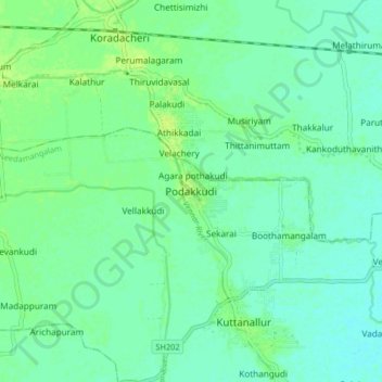
Name: Topografische Karte Podakkudi, Höhe, Relief.
Durchschnittliche Höhe: 15 m
Minimale Höhe: 9 m
Maximale Höhe: 22 m
Spenden