Geolokalisieren
👉 Easily get elevation data in JSON, GeoTIFF and KML formats using Elevation API
Vielen Dank für die Unterstützung dieser Website ❤️
Spenden

Topografische Karte Mangangate River

Klicken Sie auf die Karte, um die Höhe anzuzeigen.

👉 Easily get elevation data in JSON, GeoTIFF and KML formats using Elevation API
Vielen Dank für die Unterstützung dieser Website ❤️
Spenden

Über diese Karte

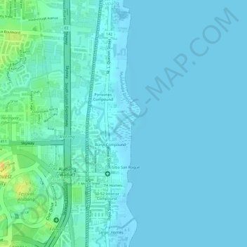
Name: Topografische Karte Mangangate River, Höhe, Relief.

Ort: Mangangate River, Alabang, Muntinlupa District 2, Muntinlupa, Southern Manila District, Metro Manila, 1781, Philippines (14.42360 121.05058 14.42578 121.05336)

Durchschnittliche Höhe: 6 m

Minimale Höhe: 1 m

Maximale Höhe: 34 m

👉 Easily get elevation data in JSON, GeoTIFF and KML formats using Elevation API
Vielen Dank für die Unterstützung dieser Website ❤️
Spenden

Andere topografische Karten

Klicken Sie auf eine Karte, um ihre Topografie, ihre Höhe und ihr Relief anzuzeigen.

Sucat

Philippines > Muntinlupa

Durchschnittliche Höhe: 11 m

Muntinlupa

Philippines > Muntinlupa

There are three plausible origins of the name of the city: First, is its association with the thin topsoil in the area; second, residents, purportedly replying to a question by Spaniards in the 16th century what the name of their place was, said “Monte sa Lupa”—apparently mistaking the question for what…

Durchschnittliche Höhe: 22 m

Alabang

Philippines > Muntinlupa

Durchschnittliche Höhe: 13 m

Bayanan

Philippines > Muntinlupa

Durchschnittliche Höhe: 8 m

Vielen Dank für die Unterstützung dieser Website ❤️
Spenden

Cupang

Philippines > Muntinlupa

Durchschnittliche Höhe: 8 m

Buli

Philippines > Muntinlupa

Durchschnittliche Höhe: 10 m

Ayala Alabang

Philippines > Muntinlupa

Durchschnittliche Höhe: 33 m

Poblacion

Philippines > Muntinlupa

Durchschnittliche Höhe: 21 m

Vielen Dank für die Unterstützung dieser Website ❤️
Spenden

Muntinlupa

Philippines > Muntinlupa

There are three plausible origins of the name of the city: First, is its association with the thin topsoil in the area; second, residents, purportedly replying to a question by Spaniards in the 16th century what the name of their place was, said “Monte sa Lupa”—apparently mistaking the question for what…

Durchschnittliche Höhe: 41 m

Alabang

Philippines > Muntinlupa

Durchschnittliche Höhe: 13 m

Ayala Alabang

Philippines > Muntinlupa

Durchschnittliche Höhe: 33 m

Poblacion

Philippines > Muntinlupa

Durchschnittliche Höhe: 21 m

Vielen Dank für die Unterstützung dieser Website ❤️
Spenden

Poblacion

Philippines > Muntinlupa

Durchschnittliche Höhe: 21 m

Buli

Philippines > Muntinlupa

Durchschnittliche Höhe: 10 m

Putatan

Philippines > Muntinlupa

Durchschnittliche Höhe: 16 m

Sucat

Philippines > Muntinlupa

Durchschnittliche Höhe: 11 m

Vielen Dank für die Unterstützung dieser Website ❤️
Spenden

Alabang

Philippines > Muntinlupa

Durchschnittliche Höhe: 13 m

Alabang

Philippines > Muntinlupa

Durchschnittliche Höhe: 13 m