
Topografische Karte Cumbum
Klicken Sie auf die Karte, um die Höhe anzuzeigen.
Cumbum
Cumbum is located at 9°44′N 77°18′E / 9.73°N 77.3°E / 9.73; 77.3. It has an average elevation of 391meters (1282 feet). One can see the backdrop of Kodaikanal Hills from Cumbum. Apart from that Cumbum has most vigorous activity in agriculture.
Über diese Karte
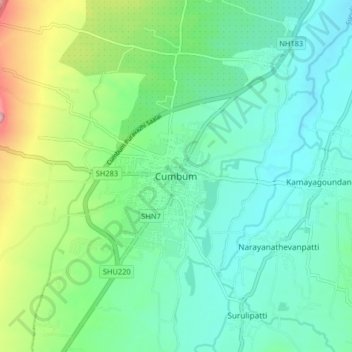
Name: Topografische Karte Cumbum, Höhe, Relief.
Ort: Cumbum, Uthamapalayam, Theni, Tamil Nadu, 625516, India (9.69941 77.24530 9.77941 77.32530)
Durchschnittliche Höhe: 432 m
Minimale Höhe: 370 m
Maximale Höhe: 612 m