
Vielen Dank für die Unterstützung dieser Website ❤️
Spenden
Spenden
Topografische Karte Karakoram Pass
Klicken Sie auf die Karte, um die Höhe anzuzeigen.
Vielen Dank für die Unterstützung dieser Website ❤️
Spenden
Spenden
Karakoram Pass
Historically, the high altitude of the pass and the lack of fodder were responsible for the deaths of countless pack animals while the route was notorious for the trail of bones strewn along the way. There is an almost total absence of vegetation on the approaches to the pass.
Vielen Dank für die Unterstützung dieser Website ❤️
Spenden
Spenden
Über diese Karte
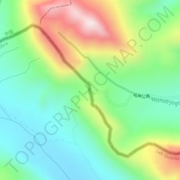
Name: Topografische Karte Karakoram Pass, Höhe, Relief.
Ort: Karakoram Pass, Nubra, Leh District, Ladakh, India (35.51341 77.82265 35.51351 77.82275)
Durchschnittliche Höhe: 5.521 m
Minimale Höhe: 5.300 m
Maximale Höhe: 5.931 m
Vielen Dank für die Unterstützung dieser Website ❤️
Spenden
Spenden