
Topografische Karte Boskoop
Interaktive Karte
Klicken Sie auf die Karte, um die Höhe anzuzeigen.
Über diese Karte
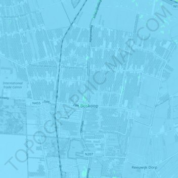
Name: Topografische Karte Boskoop, Höhe, Relief.
Ort: Boskoop, Alphen aan den Rijn, South Holland, Netherlands (52.05910 4.62530 52.09955 4.71551)
Durchschnittliche Höhe: -2 m
Minimale Höhe: -8 m
Maximale Höhe: 2 m
Andere topografische Karten
Klicken Sie auf eine Karte, um ihre Topografie, ihre Höhe und ihr Relief anzuzeigen.
Gorinchem
Netherlands > South Holland > Gorinchem
Gorinchem, South Holland, Netherlands
Durchschnittliche Höhe: 1 m
Spijkenisse
Spijkenisse, Nissewaard, South Holland, Netherlands
Durchschnittliche Höhe: 1 m
Dordrecht
Dordrecht, South Holland, Netherlands
Durchschnittliche Höhe: 1 m
Vlaardingen
Netherlands > South Holland > Vlaardingen
Vlaardingen, South Holland, Netherlands
Durchschnittliche Höhe: 1 m
Hoogvliet Rotterdam
Netherlands > South Holland > Hoogvliet Rotterdam
Hoogvliet Rotterdam, Rotterdam, South Holland, Netherlands
Durchschnittliche Höhe: 2 m
Rotterdam
Rotterdam, South Holland, Netherlands
Durchschnittliche Höhe: 0 m
Capelle aan den IJssel
Capelle aan den IJssel, South Holland, Netherlands
Durchschnittliche Höhe: -1 m
Katwijk
Netherlands > South Holland > Katwijk
Katwijk, South Holland, Netherlands
Durchschnittliche Höhe: 3 m
Noordwijk
Netherlands > South Holland > Noordwijk
Noordwijk, South Holland, Netherlands
Durchschnittliche Höhe: 1 m
Monster
Netherlands > South Holland > Monster > Monster
Monster, Westland, South Holland, Netherlands, 2681, Netherlands
Durchschnittliche Höhe: 1 m
Zoetermeer
Netherlands > South Holland > Zoetermeer
Zoetermeer, South Holland, Netherlands
Durchschnittliche Höhe: -3 m