
Topografische Karte Tagum
Klicken Sie auf die Karte, um die Höhe anzuzeigen.
Tagum
One of the significant accomplishments of the officialdom of Tagum during the 1990s was its elevation from a second to the first-class municipality. This opened a gateway to increase its financial resources through the Internal Revenue Allocation (IRA) from the national government and local revenues.
Über diese Karte
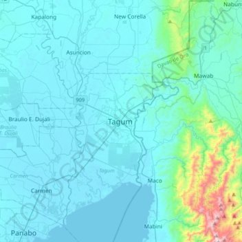
Name: Topografische Karte Tagum, Höhe, Relief.
Ort: Tagum, Davao del Norte, Davao Region, 8100, Philippines (7.28702 125.65118 7.60702 125.97118)
Durchschnittliche Höhe: 103 m
Minimale Höhe: 0 m
Maximale Höhe: 1.143 m