
Topografische Karte Padang
Klicken Sie auf die Karte, um die Höhe anzuzeigen.
Über diese Karte
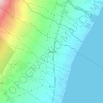
Name: Topografische Karte Padang, Höhe, Relief.
Ort: Padang, Albay, Bicol Region, 4508, Philippines (13.18907 123.73376 13.22907 123.77376)
Durchschnittliche Höhe: 57 m
Minimale Höhe: -1 m
Maximale Höhe: 259 m
Andere topografische Karten
Klicken Sie auf eine Karte, um ihre Topografie, ihre Höhe und ihr Relief anzuzeigen.
Polangui
known during the early times that the barrio has vas and fertile agricultural land, and because of this, settlers from nearby places migrated to this barrio to venture in agricultural farming. One of the early settlers who migrated to this barrio came from barrio La Medalla, town of Iriga (now a City) of the…
Durchschnittliche Höhe: 193 m
Daraga
67.3% of the total municipal land area has a predominantly low elevation of up to 100 metres (330 ft). The surface terrain is generally characterized by combination of level to nearly level areas, gentle to undulating areas and undulating to rolling areas.
Durchschnittliche Höhe: 124 m