
Vielen Dank für die Unterstützung dieser Website ❤️
Spenden
Spenden
Topografische Karte Sonogno
Klicken Sie auf die Karte, um die Höhe anzuzeigen.
Vielen Dank für die Unterstützung dieser Website ❤️
Spenden
Spenden
Sonogno
The village is located in the Locarno district, Sonogno is the last village on the paved road through the Valley Verzasca. All motor vehicles are required to park at the entrance to the village. It is located at an elevation of 918 m (3,012 ft) about 30 km (19 mi) from Locarno.
Vielen Dank für die Unterstützung dieser Website ❤️
Spenden
Spenden
Über diese Karte
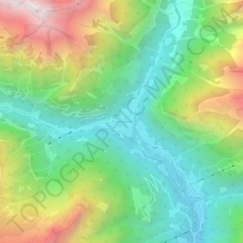
Name: Topografische Karte Sonogno, Höhe, Relief.
Durchschnittliche Höhe: 1.434 m
Minimale Höhe: 842 m
Maximale Höhe: 2.513 m
Vielen Dank für die Unterstützung dieser Website ❤️
Spenden
Spenden