Geolokalisieren

Topografische Karte Mojave

Interaktive Karte

Klicken Sie auf die Karte, um die Höhe anzuzeigen.

Über diese Karte

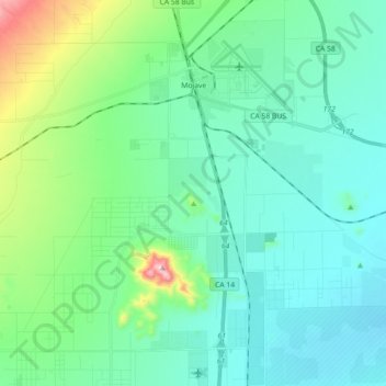
Name: Topografische Karte Mojave, Höhe, Relief.

Ort: Mojave, Kern County, California, United States (34.93736 -118.25786 35.08440 -118.10427)

Durchschnittliche Höhe: 857 m

Minimale Höhe: 760 m

Maximale Höhe: 1.274 m

Mojave (formerly Mohave) is an unincorporated community in Kern County, California, United States. Mojave is located 50 miles (80 km) east of Bakersfield, and 100 miles (161 km) north of Los Angeles, at an elevation of 2,762 feet (842 m). The town is located in the western region of the Mojave Desert, below and east of Oak Creek Pass and the Tehachapi Mountains. Mojave is on the Pacific Crest Trail.

Wikipedia (CC-BY-SA 3.0)

Andere topografische Karten

Klicken Sie auf eine Karte, um ihre Topografie, ihre Höhe und ihr Relief anzuzeigen.

Tehachapi

United States > California > Kern County

Tehachapi, Kern County, California, 93561, United States

Durchschnittliche Höhe: 1.414 m

Wasco

United States > California > Kern County

Wasco, Kern County, California, United States

Durchschnittliche Höhe: 101 m

Cantil

United States > California > Kern County

Cantil, Kern County, California, United States

Durchschnittliche Höhe: 628 m

Woodford

United States > California > Kern County

Woodford, El Rita, Kern County, California, 93531, United States

Durchschnittliche Höhe: 899 m

City of Shafter

United States > California > Kern County

City of Shafter, Kern County, California, United States

Durchschnittliche Höhe: 118 m

Tehachapi Mountain

United States > California > Kern County

Tehachapi Mountain, Kern County, California, United States

Durchschnittliche Höhe: 2.142 m

Rosamond

United States > California > Kern County

Rosamond, Kern County, California, 93560, United States

Durchschnittliche Höhe: 749 m

Baker

United States > California > Kern County > Boron

Baker, Boron, Kern County, California, United States

Durchschnittliche Höhe: 765 m

Gulf

United States > California > Kern County

Gulf, Kern County, CAL Fire Contract Counties, California, United States

Durchschnittliche Höhe: 88 m

Kern City

United States > California > Kern County > Bakersfield

Kern City, Bakersfield, Kern County, CAL Fire Southern Region, California, 93309, United States

Durchschnittliche Höhe: 119 m

Golden Hills

United States > California > Kern County > Golden Hills

Golden Hills, Kern County, California, United States

Durchschnittliche Höhe: 1.275 m

Onyx

United States > California > Kern County

Onyx, Kern County, California, 93255, United States

Durchschnittliche Höhe: 1.205 m

Arvin

United States > California > Kern County

Arvin, Kern County, California, United States

Durchschnittliche Höhe: 130 m

California City

United States > California > Kern County

California City, Kern County, California, United States

Durchschnittliche Höhe: 845 m

Buttonwillow

United States > California > Kern County > Buttonwillow

Buttonwillow, Kern County, California, 93206, United States

Durchschnittliche Höhe: 87 m

Rosedale

United States > California > Kern County

Rosedale, Kern County, CAL Fire Southern Region, California, United States

Durchschnittliche Höhe: 107 m

Frazier Park

United States > California > Kern County

Frazier Park, Kern County, California, United States

Durchschnittliche Höhe: 1.533 m

Oil City

United States > California > Kern County

Oil City, Kern River Oil Field, Kern County, California, 93305, United States

Durchschnittliche Höhe: 162 m

Walong

United States > California > Kern County > Keene

Walong, Keene, Kern County, California, United States

Durchschnittliche Höhe: 998 m

McKittrick

United States > California > Kern County

McKittrick, Kern County, California, 93251, United States

Durchschnittliche Höhe: 388 m

Taft

United States > California > Kern County > Taft > Taft

Taft, Kern County, California, 93268, United States

Durchschnittliche Höhe: 301 m

China Lake

United States > California > Kern County > Ridgecrest > China Lake

China Lake, Ridgecrest, Kern County, California, 93555-2508, United States

Durchschnittliche Höhe: 689 m

Goler Heights

United States > California > Kern County > Goler Heights

Goler Heights, Kern County, California, United States

Durchschnittliche Höhe: 822 m

Edison

United States > California > Kern County

Edison, Kern County, California, 93303, United States

Durchschnittliche Höhe: 178 m

Taft

United States > California > Kern County

Taft, Kern County, California, 93268, United States

Durchschnittliche Höhe: 370 m

Pine Mountain Club

United States > California > Kern County

Pine Mountain Club, Kern County, California, 93222, United States

Durchschnittliche Höhe: 1.867 m

Rowen

United States > California > Kern County

Rowen, Kern County, California, 93531, United States

Durchschnittliche Höhe: 806 m

Bakersfield

United States > California > Kern County

Bakersfield, Kern County, California, United States

Durchschnittliche Höhe: 157 m

Edwards Air Force Base

United States > California > Kern County

Edwards Air Force Base, Kern County, California, United States

Durchschnittliche Höhe: 730 m

Lebec

United States > California > Kern County

Lebec, Kern County, California, 93243, United States

Durchschnittliche Höhe: 1.162 m

Rosedale

United States > California > Kern County

Rosedale, Kern County, California, United States

Durchschnittliche Höhe: 113 m

Inyokern

United States > California > Kern County > Inyokern

Inyokern, Kern County, California, United States

Durchschnittliche Höhe: 753 m

Kernville

United States > California > Kern County

Kernville, Kern County, California, 93238, United States

Durchschnittliche Höhe: 1.135 m