
Topografische Karte Auroville
Klicken Sie auf die Karte, um die Höhe anzuzeigen.
Auroville
It is included in the sub-humid tropics (wet-and-dry tropical climate) situated on a plateau region with its maximum elevation of 32 m (105 ft) above sea level located in the Matrimandir area. The annual rainfall average is 1,200 mm (47 in) mainly from the SW monsoon (June to Sept.) and NE monsoon (Nov to Dec) with a dry period of approx 6 months. The average maximum temperature is 32.2 °C (90.0 °F), average minimum 20 °C (68 °F).
Über diese Karte
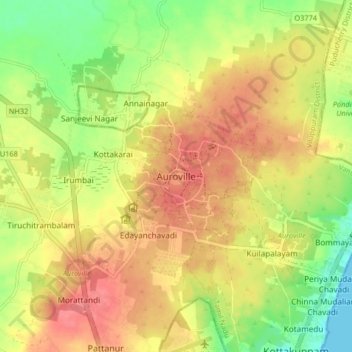
Name: Topografische Karte Auroville, Höhe, Relief.
Ort: Auroville, Vanur, Viluppuram, Tamil Nadu, 605101, India (11.96739 79.76995 12.04739 79.84995)
Durchschnittliche Höhe: 36 m
Minimale Höhe: 0 m
Maximale Höhe: 63 m
Andere topografische Karten
Klicken Sie auf eine Karte, um ihre Topografie, ihre Höhe und ihr Relief anzuzeigen.