Geolokalisieren
👉 Easily get elevation data in JSON, GeoTIFF and KML formats using Elevation API
Vielen Dank für die Unterstützung dieser Website ❤️
Spenden

Topografische Karte Footy's Hill

Klicken Sie auf die Karte, um die Höhe anzuzeigen.

👉 Easily get elevation data in JSON, GeoTIFF and KML formats using Elevation API
Vielen Dank für die Unterstützung dieser Website ❤️
Spenden

Über diese Karte

Name: Topografische Karte Footy's Hill, Höhe, Relief.

Ort: Footy's Hill, Huntingdon ED, 
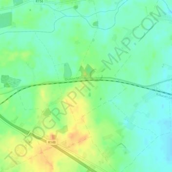
The Municipal District of Mullingar — Kinnegad, County Westmeath, Leinster, Ireland (53.48419 -7.18521 53.50419 -7.16521)

Durchschnittliche Höhe: 95 m

Minimale Höhe: 82 m

Maximale Höhe: 114 m

👉 Easily get elevation data in JSON, GeoTIFF and KML formats using Elevation API
Vielen Dank für die Unterstützung dieser Website ❤️
Spenden

Andere topografische Karten

Klicken Sie auf eine Karte, um ihre Topografie, ihre Höhe und ihr Relief anzuzeigen.

Castletown Geoghegan

Ireland > County Westmeath

Durchschnittliche Höhe: 96 m

Ballyloughloe

Ireland > County Westmeath

Durchschnittliche Höhe: 72 m

Kilbixy

Ireland > County Westmeath

Durchschnittliche Höhe: 67 m

Rathconrath

Ireland > County Westmeath

Durchschnittliche Höhe: 121 m

Vielen Dank für die Unterstützung dieser Website ❤️
Spenden

Ballymore

Ireland > County Westmeath

Durchschnittliche Höhe: 83 m

Knockdrin

Ireland > County Westmeath

Durchschnittliche Höhe: 98 m

Raharney

Ireland > County Westmeath

Durchschnittliche Höhe: 79 m

Kinnegad

Ireland > County Westmeath > Kinnegad

Durchschnittliche Höhe: 75 m

Vielen Dank für die Unterstützung dieser Website ❤️
Spenden

Banagher

Ireland > County Westmeath

Durchschnittliche Höhe: 96 m

Castlelost

Ireland > County Westmeath

Durchschnittliche Höhe: 93 m

Toberclare

Ireland > County Westmeath

Durchschnittliche Höhe: 62 m

Vielen Dank für die Unterstützung dieser Website ❤️
Spenden

Moate

Ireland > County Westmeath

Durchschnittliche Höhe: 76 m

Rochfortbridge

Ireland > County Westmeath

Durchschnittliche Höhe: 90 m

Lough Bane

Ireland > County Westmeath

Durchschnittliche Höhe: 66 m

Glassan

Ireland > County Westmeath

Durchschnittliche Höhe: 57 m

Vielen Dank für die Unterstützung dieser Website ❤️
Spenden

Dysart

Ireland > County Westmeath

Durchschnittliche Höhe: 84 m

Tyrrellspass

Ireland > County Westmeath

Durchschnittliche Höhe: 100 m

Athlone

Ireland > County Westmeath

Durchschnittliche Höhe: 43 m

Lough Sewdy

Ireland > County Westmeath

Durchschnittliche Höhe: 86 m

Vielen Dank für die Unterstützung dieser Website ❤️
Spenden

Ardnurcher

Ireland > County Westmeath

Durchschnittliche Höhe: 71 m

Lough Bane

Ireland > County Westmeath

Durchschnittliche Höhe: 130 m

Hiskinstown

Ireland > County Westmeath

Durchschnittliche Höhe: 85 m

Clonkill

Ireland > County Westmeath

Durchschnittliche Höhe: 115 m

Vielen Dank für die Unterstützung dieser Website ❤️
Spenden

Lough Sheever

Ireland > County Westmeath

Durchschnittliche Höhe: 98 m

Collinstown

Ireland > County Westmeath

Durchschnittliche Höhe: 108 m

Kinnegad

Ireland > County Westmeath

Durchschnittliche Höhe: 75 m

Multyfarnham

Ireland > County Westmeath

Durchschnittliche Höhe: 81 m

Vielen Dank für die Unterstützung dieser Website ❤️
Spenden

Battstown

Ireland > County Westmeath

Durchschnittliche Höhe: 94 m

Delvin

Ireland > County Westmeath

Durchschnittliche Höhe: 89 m

Clondardis

Ireland > County Westmeath

Durchschnittliche Höhe: 112 m

Gallstown

Ireland > County Westmeath

Durchschnittliche Höhe: 92 m

Vielen Dank für die Unterstützung dieser Website ❤️
Spenden

Knockmant

Ireland > County Westmeath

Durchschnittliche Höhe: 96 m

Nure Bog

Ireland > County Westmeath

Durchschnittliche Höhe: 85 m

Ballynacarrigy

Ireland > County Westmeath

Durchschnittliche Höhe: 71 m

Ballymore

Ireland > County Westmeath

Durchschnittliche Höhe: 81 m

Vielen Dank für die Unterstützung dieser Website ❤️
Spenden

Lough Ennell

Ireland > County Westmeath

Durchschnittliche Höhe: 86 m

Lough Derravaragh

Ireland > County Westmeath

Durchschnittliche Höhe: 85 m

Lough Lene

Ireland > County Westmeath

The lake is described in Samuel Lewis's Topographical Dictionary of Ireland (1837) as being an irregular oval shape, possibly 3.2 km (2.0 mi) long by 1.7 km (1.1 mi) broad. A fresh water lake, most sources focus on the clarity of the water, with the term "gin clear" being used to describe it. It sits…

Durchschnittliche Höhe: 109 m

Vielen Dank für die Unterstützung dieser Website ❤️
Spenden

Kiltoom

Ireland > County Westmeath

Durchschnittliche Höhe: 80 m

Muckanagh

Ireland > County Westmeath

Durchschnittliche Höhe: 38 m

Milltown

Ireland > County Westmeath

Durchschnittliche Höhe: 84 m

Simonstown

Ireland > County Westmeath > Simonstown

Durchschnittliche Höhe: 80 m

Vielen Dank für die Unterstützung dieser Website ❤️
Spenden

Clonmoyle

Ireland > County Westmeath

Durchschnittliche Höhe: 108 m

Kilbeggan

Ireland > County Westmeath

Durchschnittliche Höhe: 71 m

Clonmore

Ireland > County Westmeath

Durchschnittliche Höhe: 54 m

Griffinstown

Ireland > County Westmeath

Durchschnittliche Höhe: 83 m

Vielen Dank für die Unterstützung dieser Website ❤️
Spenden

Paslicktown

Ireland > County Westmeath

Durchschnittliche Höhe: 104 m

Balrath

Ireland > County Westmeath

Durchschnittliche Höhe: 128 m

Ballykilroe

Ireland > County Westmeath

Durchschnittliche Höhe: 89 m

Ballynaskeagh

Ireland > County Westmeath

Durchschnittliche Höhe: 90 m

Vielen Dank für die Unterstützung dieser Website ❤️
Spenden

Kiltotan and Collinstown

Ireland > County Westmeath

Durchschnittliche Höhe: 97 m

Adamstown

Ireland > County Westmeath

Durchschnittliche Höhe: 128 m

Mullingar

Ireland > County Westmeath

Durchschnittliche Höhe: 99 m

Garrycastle

Ireland > County Westmeath

Durchschnittliche Höhe: 49 m

Vielen Dank für die Unterstützung dieser Website ❤️
Spenden

Athlone

Ireland > County Westmeath

Durchschnittliche Höhe: 43 m

Kilbeggan

Ireland > County Westmeath

Durchschnittliche Höhe: 71 m

Dungolman River

Ireland > County Westmeath

Durchschnittliche Höhe: 58 m

Kilbeggan

Ireland > County Westmeath

Durchschnittliche Höhe: 71 m

Vielen Dank für die Unterstützung dieser Website ❤️
Spenden

Portlick

Ireland > County Westmeath

Durchschnittliche Höhe: 46 m

Lough Derravaragh

Ireland > County Westmeath

Durchschnittliche Höhe: 85 m

Rathconrath

Ireland > County Westmeath

Durchschnittliche Höhe: 121 m

Ballymore

Ireland > County Westmeath

Durchschnittliche Höhe: 81 m

Vielen Dank für die Unterstützung dieser Website ❤️
Spenden

Simonstown

Ireland > County Westmeath

Durchschnittliche Höhe: 112 m

Silver

Ireland > County Westmeath

Durchschnittliche Höhe: 67 m

Street

Ireland > County Westmeath

Durchschnittliche Höhe: 73 m

Collinstown

Ireland > County Westmeath

Durchschnittliche Höhe: 108 m

Vielen Dank für die Unterstützung dieser Website ❤️
Spenden

Silver

Ireland > County Westmeath

Durchschnittliche Höhe: 67 m

River Brosna

Ireland > County Westmeath > Mullingar

Durchschnittliche Höhe: 100 m

Nahod More

Ireland > County Westmeath

Durchschnittliche Höhe: 89 m

Vielen Dank für die Unterstützung dieser Website ❤️
Spenden

Clonmellon

Ireland > County Westmeath

Durchschnittliche Höhe: 91 m