
Topografische Karte Cock Bridge
Klicken Sie auf die Karte, um die Höhe anzuzeigen.
Über diese Karte
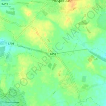
Name: Topografische Karte Cock Bridge, Höhe, Relief.
Durchschnittliche Höhe: 89 m
Minimale Höhe: 78 m
Maximale Höhe: 102 m
Andere topografische Karten
Klicken Sie auf eine Karte, um ihre Topografie, ihre Höhe und ihr Relief anzuzeigen.
Leixlip
British publisher and cartographer Samuel Lewis mentions Confey Castle in the first volume of his 1837 work A Topographical Dictionary of Ireland. In it, he comments that Confey's (or Confoy as he spells it) population was 165, had formerly had a town and a castle of some importance, which were noticed by…
Durchschnittliche Höhe: 55 m
Kildare Round Tower
A Topographical Dictionary of Ireland states "One of the ancient round towers stood here till 1807 when it was pulled down to make room for the belfry of the church".
Durchschnittliche Höhe: 100 m
Leixlip
Ireland > County Kildare > Leixlip
British publisher and cartographer Samuel Lewis mentions Confey Castle in the first volume of his 1837 work A Topographical Dictionary of Ireland. In it, he comments that Confey's (or Confoy as he spells it) population was 165, had formerly had a town and a castle of some importance, which were noticed by…
Durchschnittliche Höhe: 53 m
Leixlip
British publisher and cartographer Samuel Lewis mentions Confey Castle in the first volume of his 1837 work A Topographical Dictionary of Ireland. In it, he comments that Confey's (or Confoy as he spells it) population was 165, had formerly had a town and a castle of some importance, which were noticed by…
Durchschnittliche Höhe: 55 m