Topografische Karte Boreas Pass
Klicken Sie auf die Karte, um die Höhe anzuzeigen.
Boreas Pass
Boreas Pass (elevation 11,481 ft (3,499 m)) is a high mountain pass in central Colorado, in the Rocky Mountains of the western United States. The pass is located on the continental divide, at the crest of the Front Range along the border between Park (south) and Summit counties.
Über diese Karte
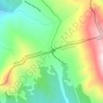
Name: Topografische Karte Boreas Pass, Höhe, Relief.
Ort: Boreas Pass, Summit County, Colorado, United States (39.41034 -105.96849 39.41044 -105.96839)
Durchschnittliche Höhe: 3.559 m
Minimale Höhe: 3.311 m
Maximale Höhe: 3.942 m
Andere topografische Karten
Klicken Sie auf eine Karte, um ihre Topografie, ihre Höhe und ihr Relief anzuzeigen.