
Topografische Karte Liberty Island
Interaktive Karte
Klicken Sie auf die Karte, um die Höhe anzuzeigen.
Über diese Karte
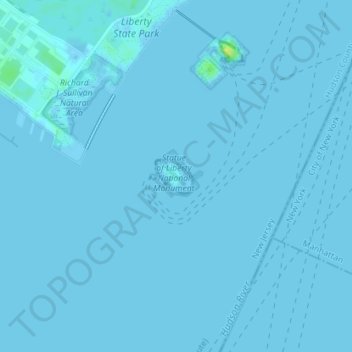
Name: Topografische Karte Liberty Island, Höhe, Relief.
Durchschnittliche Höhe: 0 m
Minimale Höhe: -1 m
Maximale Höhe: 17 m
Andere topografische Karten
Klicken Sie auf eine Karte, um ihre Topografie, ihre Höhe und ihr Relief anzuzeigen.
Todt Hill
United States of America > New York > New York
Todt Hill, Staten Island, New York, Richmond County, New York, 10304, United States of America
Durchschnittliche Höhe: 75 m
Wards Island
United States of America > New York > New York
Wards Island, Manhattan Community Board 11, Manhattan, New York County, New York, 11102, United States of America
Durchschnittliche Höhe: 35 m
Manhattan
United States of America > New York > New York
Chinatown, Manhattan Community Board 2, Manhattan, New York County, New York, United States of America
Durchschnittliche Höhe: 12 m