
Topografische Karte Rockingham
Interaktive Karte
Klicken Sie auf die Karte, um die Höhe anzuzeigen.
Rockingham
The highest point in town is Berry Hill at 478 m/1568 ft elevation, near the northwestern corner of the town. The lowest point is on the Connecticut River at the southern boundary of town, at 73 m/240 ft elevation.
Über diese Karte
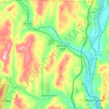
Name: Topografische Karte Rockingham, Höhe, Relief.
Ort: Rockingham, Windham County, Vermont, United States (43.12503 -72.55798 43.23590 -72.43427)
Durchschnittliche Höhe: 227 m
Minimale Höhe: 66 m
Maximale Höhe: 493 m
Andere topografische Karten
Klicken Sie auf eine Karte, um ihre Topografie, ihre Höhe und ihr Relief anzuzeigen.