
Topografische Karte Fredericktown
Interaktive Karte
Klicken Sie auf die Karte, um die Höhe anzuzeigen.
Über diese Karte
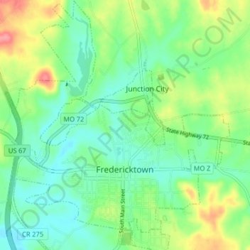
Name: Topografische Karte Fredericktown, Höhe, Relief.
Durchschnittliche Höhe: 234 m
Minimale Höhe: 207 m
Maximale Höhe: 288 m
Also found west of Fredericktown but still within Madison County is Black Mountain. Highway E runs along the base of Black Mountain, beside the St. Francis River. While Black Mountain is only the 42nd highest (above sea level) in Missouri, Black Mountain has the largest difference in elevation from the base to the summit. The St. Francis River, at the base of Black Mountain, is approximately 540 feet above sea level. The summit of Black Mountain is 1,502 feet above sea level, which is a difference of approximately 962 feet. In contrast, Taum Sauk Mountain, the highest in Missouri, only rises about 700 feet from its base, because it rises from an already elevated plain. Taum Sauk is the highest mountain in Missouri; Black Mountain is the tallest.
Andere topografische Karten
Klicken Sie auf eine Karte, um ihre Topografie, ihre Höhe und ihr Relief anzuzeigen.
Cornwall
United States > Missouri > Madison County
Cornwall, Madison County, Missouri, United States
Durchschnittliche Höhe: 239 m
Jewett
United States > Missouri > Madison County
Jewett, Madison County, Missouri, 63636, United States
Durchschnittliche Höhe: 199 m
Marquand
United States > Missouri > Madison County
Marquand, Madison County, Missouri, United States
Durchschnittliche Höhe: 193 m