
Topografische Karte Pangatatan Island
Interaktive Karte
Klicken Sie auf die Karte, um die Höhe anzuzeigen.
Über diese Karte
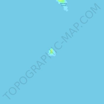
Name: Topografische Karte Pangatatan Island, Höhe, Relief.
Ort: Pangatatan Island, Cuyo, Mimaropa, 5318, Philippines (10.69282 120.88573 10.69496 120.88787)
Durchschnittliche Höhe: 0 m
Minimale Höhe: 0 m
Maximale Höhe: 16 m
Andere topografische Karten
Klicken Sie auf eine Karte, um ihre Topografie, ihre Höhe und ihr Relief anzuzeigen.
Cavili Island
Cavili Island, Cagayancillo, Mimaropa, 5321, Philippines
Durchschnittliche Höhe: 1 m
Patonggong Maliit Island
Patonggong Maliit Island, Balabac, Mimaropa, 5307, Philippines
Durchschnittliche Höhe: 0 m
South Mangsee Island
South Mangsee Island, Balabac, Mimaropa, Philippines
Durchschnittliche Höhe: 1 m
Lumbucan Island
Lumbucan Island, Balabac, Mimaropa, Philippines
Durchschnittliche Höhe: 1 m
Dumaran Island
Dumaran Island, Mimaropa, Philippines
Durchschnittliche Höhe: 10 m
Lean Island
Lean Island, Cuyo, Mimaropa, 5318, Philippines
Durchschnittliche Höhe: 0 m
Bancoran Island
Bancoran Island, Mimaropa, Philippines
Durchschnittliche Höhe: 0 m
Siparay Island
Siparay Island, Magsaysay, Mimaropa, 5319, Philippines
Durchschnittliche Höhe: 0 m
Pulaw Talam Island
Pulaw Talam Island, Mimaropa, Philippines
Durchschnittliche Höhe: 0 m
Tres Marias Islands
Philippines > Mimaropa > Puerto Princesa
Tres Marias Islands, Puerto Princesa, Mimaropa, 5300, Philippines
Durchschnittliche Höhe: 74 m
Ulugan Bay
Philippines > Mimaropa > Buenavista
Ulugan Bay, Buenavista, Puerto Princesa, Mimaropa, Philippines
Durchschnittliche Höhe: 0 m
Emelina Island
Emelina Island, Mimaropa, Philippines
Durchschnittliche Höhe: 0 m
Gabung Island
Gabung Island, Balabac, Mimaropa, Philippines
Durchschnittliche Höhe: 3 m
Secam Island
Secam Island, Balabac, Mimaropa, Philippines
Durchschnittliche Höhe: 0 m
Parunponon Island
Philippines > Mimaropa > Puerto Princesa
Parunponon Island, Puerto Princesa, Mimaropa, 5300, Philippines
Durchschnittliche Höhe: 0 m
Comiran Island
Comiran Island, Balabac, Mimaropa, Philippines
Durchschnittliche Höhe: 0 m
Cocoro Island
Cocoro Island, Magsaysay, Mimaropa, 5319, Philippines
Durchschnittliche Höhe: 1 m
Langisan Islands
Langisan Islands, Cagayancillo, Mimaropa, 5321, Philippines
Durchschnittliche Höhe: 0 m
Tagalinog Island
Tagalinog Island, Mimaropa, Philippines
Durchschnittliche Höhe: 0 m
Quiniluban Island
Quiniluban Island, Agutaya, Mimaropa, 5320, Philippines
Durchschnittliche Höhe: 33 m
Candaraman Island
Candaraman Island, Balabac, Mimaropa, Philippines
Durchschnittliche Höhe: 2 m
Lubid Island
Lubid Island, Cuyo, Mimaropa, 5318, Philippines
Durchschnittliche Höhe: 12 m
Small Pagbo Island
Small Pagbo Island, Mimaropa, Philippines
Durchschnittliche Höhe: 0 m
Fondeado Island
Philippines > Mimaropa > Puerto Princesa
Fondeado Island, Puerto Princesa, Mimaropa, 5300, Philippines
Durchschnittliche Höhe: 0 m
Indagamy Island
Indagamy Island, Magsaysay, Mimaropa, 5319, Philippines
Durchschnittliche Höhe: 0 m
North Verde Island
North Verde Island, Mimaropa, Philippines
Durchschnittliche Höhe: 1 m
Nagtabon Beach
Philippines > Mimaropa > Bacungan
Nagtabon Beach, Bacungan-Nagtabon Rd, Bacungan, Puerto Princesa, Mimaropa, Philippines
Durchschnittliche Höhe: 67 m
Bacungan
Philippines > Mimaropa > Bacungan
Bacungan, Puerto Princesa, Mimaropa, Philippines
Durchschnittliche Höhe: 82 m
Tacbubuc Island
Tacbubuc Island, Magsaysay, Mimaropa, 5319, Philippines
Durchschnittliche Höhe: 0 m
Cacbucao Island
Cacbucao Island, Mimaropa, Philippines
Durchschnittliche Höhe: 0 m
Manuc Manucan Island
Manuc Manucan Island, Mimaropa, Philippines
Durchschnittliche Höhe: 0 m
Kalungpang Island
Philippines > Mimaropa > Puerto Princesa
Kalungpang Island, Puerto Princesa, Mimaropa, 5300, Philippines
Durchschnittliche Höhe: 0 m
Mandit Island
Mandit Island, Agutaya, Mimaropa, 5320, Philippines
Durchschnittliche Höhe: 0 m
Diit
Philippines > Mimaropa > Diit
Diit, Agutaya, Mimaropa, 5320, Philippines
Durchschnittliche Höhe: 14 m
Sanz Island
Sanz Island, Balabac, Mimaropa, Philippines
Durchschnittliche Höhe: 4 m
Bangawan Island
Bangawan Island, Mimaropa, Philippines
Durchschnittliche Höhe: 0 m
Meara Island
Philippines > Mimaropa > Puerto Princesa
Meara Island, Puerto Princesa, Mimaropa, 5300, Philippines
Durchschnittliche Höhe: 0 m
Arrecife Island
Arrecife Island, Mimaropa, Philippines
Durchschnittliche Höhe: 0 m
Paz Island
Paz Island, Balabac, Mimaropa, Philippines
Durchschnittliche Höhe: 1 m
Maracañao Island
Maracañao Island, Agutaya, Mimaropa, 5320, Philippines
Durchschnittliche Höhe: 3 m
Imalaguan Island
Imalaguan Island, Cuyo, Mimaropa, 5318, Philippines
Durchschnittliche Höhe: 1 m
North Channel Island
North Channel Island, Mimaropa, Philippines
Durchschnittliche Höhe: 0 m
Mansalangan Island
Mansalangan Island, Balabac, Mimaropa, Philippines
Durchschnittliche Höhe: 2 m
Canabungan Island
Canabungan Island, Balabac, Mimaropa, Philippines
Durchschnittliche Höhe: 1 m